Colorado Wetland Information Center Logo Colorado Wetland Information Center Logo CWIC
  • About CWIC
    • What Are Wetlands?
    • Why Are Wetlands Important?
    • Colorado Wetland Plan
    • Wetland Partners
  • Wetland Types
    • Overview
    • Ecological Systems
    • Natural Plant Communities
    • Field Guides and App
    • Fen Mapping
  • Wetland Condition
    • Overview
    • Ecological Condition
    • Habitat Quality
    • Biodiversity Significance
    • Colorado Wetland Assessment Projects
    • National Wetland Condition Assessment
    • BLM Assessment Inventory and Monitoring
  • Working in Wetlands
    • Overview
    • Conservation
    • Restoration
    • Regulation
    • Best Management Practices
    • Funding and Technical Support
  • Data & Tools
    • Wetlands Mapper
    • Floristic Quality Calculator
    • Landscape Summaries
    • Watershed Toolbox
    • Wetland Plots Database
  • Library
    • Wetland Reports
    • Potential Conservation Areas
    • County Survey Reports
    • Field Guides and App
    • Field Manuals
    • Educational Resources
  • CNHP Home

Fen Mapping

Fens are groundwater-fed wetlands with organic soils that typically support sedges and low stature shrubs and often host rare plants and animals. In the mountain west, organic soil formation can take thousands of years and long-term maintenance of fens requires protection of both hydrology and plant communities. Given the sensitivity of fens, they are a high priority for conservation and restoration. However, few land management agencies have a complete inventory of fens within their lands.

A fen in Livingston Park, Routt County.

To fill this data gap, CNHP is mapping fens through aerial photo interpretation for both the U.S. Forest Service (USFS) and the Colorado Department of Transportation (CDOT) through a series of contracts that includes mapping fens in multiple states across the West. For each project, potential fens are identified from digital aerial photography. Each potential fen polygon is hand-drawn in ArcGIS based on the best estimate of fen boundaries and is attributed with a confidence value of 1 (low confidence), 3 (possible fen) or 5 (likely fen). CNHP photo interpreters rely on multiple image sources, as well as ancillary data such as topographic maps and wetland mapping form the National Wetlands Inventory.
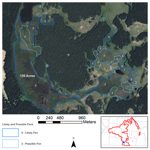
A 130 acre fen within one polygon (to the left) among a complex of likely and possible fens. This complex is in an area called Victoria Lake in Conejos County, in the Rio Grande National Forest.

Data from these projects show that fen density is strongly related to elevation and landforms. In general, fens are concentrated between 9,000–12,000 ft. in the subalpine zone. Fens form at the base of slopes, on valley margins, and in old kettle ponds. Geospatial data on fen locations will help both USFS and CDOT avoid potential impacts and target rare plant surveys in these important wetland habitats. The video below explains how the USFS is using CNHP's fen mapping data to inform management.
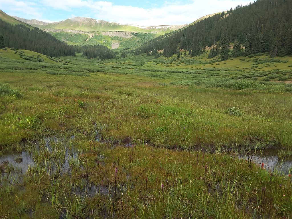
A fen near Loveland Pass (Summit/Clear Creek counties) mapped and surveyed as part of the CDOT roadside fen project.

All fen mapping by CNHP in Colorado has been combined with addition fen mapping datasets into one seamless map of Colorado fens. See the Wetlands Mapper to access the data.

Left-click to view, and right-click to download.

Below are links to Fen Mapping Reports

  • Colorado Department of Transportation Roadside Fen Inventory
  • Fen Mapping for the Bridger-Teton National Forest
  • Fen Mapping for the Dixie National Forest
  • Fen Mapping for the Ashley National Forest
  • Fen Mapping for the Manti-La Sal National Forest
  • Fen Mapping for the Salmon-Challis National Forest
  • Fen Mapping for the Rio Grande National Forest
  • Wetland Mapping and Fen Survey in the White River National Forest 2011
  • San Juan National Forest Botanical Survey of Fens
For information, contact Gabrielle Smith.

Wetland Types

Overview
Ecological Systems
Natural Plant Communities
Field Guides and App
Fen Mapping

Related Topics

Wetland Reports
PCA Reports
County Survey Reports
Field Guides and App
Field Manuals
Educational Resources
Watershed Toolbox

Web Projects

  • CODEX - Colorado’s Conservation Data Explorer
  • Rare Plant Guide Online
  • Colorado Wetland Info Center
  • COMaP - Colorado Protected Lands
  • Colorado Bat Working Group
  • STReaMS - Endangered Fishes Database
  • Colorado Native Plant Database Data Portal

About Us

  • About Us
  • Conserving Biodiversity
  • Contact Us
  • Staff Directory
  • Careers
  • Site Map
Warner College of Natural Resources Logo
  • Apply to CSU
  • Equal Opportunity
  • Disclaimer
  • Privacy Statement
  • Search CSU
  • CSU Land Acknowledgement
  • CSU Principles of Community
© 2025 Colorado Natural Heritage Program
Colorado State University Logo
  • About CWIC
    ▼
    • What Are Wetlands?
    • Why Are Wetlands Important?
    • Colorado Wetland Plan
    • Wetland Partners
  • Wetland Types
    ▼
    • Overview
    • Ecological Systems
    • Natural Plant Communities
    • Field Guides and App
    • Fen Mapping
  • Wetland Condition
    ▼
    • Overview
    • Ecological Condition
    • Habitat Quality
    • Biodiversity Significance
    • Colorado Wetland Assessment Projects
    • National Wetland Condition Assessment
    • BLM Assessment Inventory and Monitoring
  • Working in Wetlands
    ▼
    • Overview
    • Conservation
    • Restoration
    • Regulation
    • Best Management Practices
    • Funding and Technical Support
  • Data & Tools
    ▼
    • Wetlands Mapper
    • Floristic Quality Calculator
    • Landscape Summaries
    • Watershed Toolbox
    • Wetland Plots Database
  • Library
    ▼
    • Wetland Reports
    • Potential Conservation Areas
    • County Survey Reports
    • Field Guides and App
    • Field Manuals
    • Educational Resources
  • CNHP Home