CNHP conducts county surveys to locate and track occurrences of rare plants, animals, and natural plant communities, collectively known as elements of biodiversity. In an effort to protect the long-term survival of these elements, CNHP delineates Potential Conservation Areas (PCAs) and assigns biodiversity significance ranks that reflect the rarity and quality of the targeted elements. County surveys are one of the core research activities of CNHP and have resulted in numerous reports, each described below. For some counties, separate reports were written for upland and wetland resources. For other counties, the information was combined into one report. The data collected through these surveys are housed in our Biodiversity Information Management System (Biotics) database. Learn more about CNHP data, view our current tracking list, or download a map of counties surveyed by CNHP.
CNHP also inventories areas at alternative scales, such as planning areas or local open spaces. A full list of our reports, including all project-specific inventories, can be found here.
Click a link below for details or return to the clickable map
- Alamosa County
- Archuleta County
- Boulder County
- Chaffee County
- Conejos County
- Costilla County
- Delta County
- Denver County
- Dolores County
- Douglas County
- Eagle County
- El Paso County
- Fremont County
- Garfield County
- Gilpin County
- Grand County
- Gunnison County
- Hinsdale County
- Huerfano County
- Jackson County
- Jefferson County
- La Plata County
- Lake County
- Larimer County
- Las Animas County
- Mesa County
- Mineral County
- Montrose County
- Otero County
- Ouray County
- Park County
- Pitkin County
- Pueblo County
- Rio Blanco County
- Rio Grande County
- Routt County
- Saguache County
- San Juan County
- San Miguel County
- Summit County
- Teller County
Alamosa County
2003
Survey of Critical Wetlands and Riparian Areas in Southern Alamosa and Costilla Counties, San Luis Valley
Joe Rocchio
In 2003, CNHP received funding from the Colorado Department of Natural Resources (CDNR) through a grant from EPA Region 8 to survey critical wetlands within southern Alamosa and Costilla counties. Results of this project confirm that southern Alamosa and Costilla counties contain areas with high biological significance and a diverse array of wetlands that support a wide variety of plants, animals, and plant associations. At least 26 major wetland/riparian plant communities, six birds, one fish, and one plant from CNHP's Tracking List are known to occur in, or associated with, wetlands in southern Alamosa and Costilla counties. Seventeen wetland and riparian PCAs were documented. Of the 17, two sites were deemed nearly irreplaceable (B2) and 13 were of high biodiversity significance (B3). Of particular importance, the Rio Grande at Alamosa National Wildlife Refuge PCA supports populations of the Federally Endangered Southwestern Willow Flycatcher (Empidonax traillii extimus) while the Hansen Bluffs Seeps Potential Conservation Area (B3) supports a fen occurring at an uncharacteristically low elevation.

To view the full report, click here.
Archuleta County
2005
Survey of Critical Wetlands and Riparian Areas in Archuleta County
Karin Freeman, Maggie March and Denise Culver
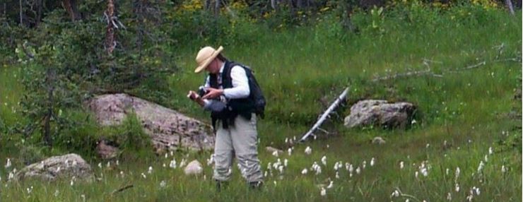
In cooperation with Colorado Parks and Wildlife (CPW), CNHP conducted a survey of critical wetlands in Archuleta County. Protection of the San Juan River watershed is a priority for CPW, Archuleta County, the Southwest Land Alliance, and CNHP due to the increasing pressures from rapid development, water diversions, and mineral extraction. The final product of this survey provides land managers with a proactive tool to guide development away from biologically sensitive wetlands. The wetland survey compliments the Upper San Juan Basin Biological Assessment carried out by CNHP in 2001-2002. Thirty-six PCAs were documented. Of these, four are nearly irreplaceable in terms of biodiversity significance (B2) and 21 are of high biodiversity significance (B3). Highlights of the survey include the discovery of several intermediate fens, including a floating peat-mat fen, which supports a globally imperiled mud sedge (Carex limosa) community and a newly discovered population of the state-rare purple marshlocks (Comarum palustre). In addition, new populations of the state-rare knotsheath sedge (Carex retrorsa), and new occurrences of the globally imperiled narrowleaf cottonwood / bluestem willow riparian community (Populus angustifolia / Salix irrorata) were documented.
To view the full report, click here.
2001/2002
Upper San Juan Basin Biological Assessment
John Sovell, Peggy Lyon and Lee Grunau
Over a span of two years, CNHP surveyed the Upper San Juan Basin for areas with high biological significance. There are several extremely rare plants and animals that depend on this area for the survival of their species. In particular, the Pagosa skyrocket (Ipomopsis polyantha) is known only from several locations in the world, all in Archuleta County. Altogether, 31 rare or imperiled plant species, 14 animal species, and 42 plant communities of concern were known in the Basin. CNHP identified 62 PCAs, one deemed as irreplaceable (B1) and 10 of very high biodiversity significance (B2).

To view the full report, click here.
Boulder County
2007/2008
Survey of Critical Biological Resources in Boulder County, Colorado
Stephanie Neid, Joanna Lemly, Jeremy Siemers, Karin Decker and Denise Culver
In 2006, Boulder County requested that CNHP survey for critical biological resources within the county. Over a span of two years, CNHP surveyed Boulder County and results of the survey confirm that there are many areas with high biological significance. Several rare plants and animals depend on these areas for survival. Altogether, 58 rare plant species, 32 rare animal species (18 vertebrate and 14 invertebrates), and 63 plant communities of concern have been documented in Boulder County. As part of this project, 225 new element occurrences were created and approximately 150 element occurrences were updated. Of particular interest are intact foothills and piedmont grassland communities in the northeastern and southeastern corners of the county, respectively. Also important are documented locations of the rare plants, like Bell’s twinpod (Physaria bellii), Larimer aletes (Aletes humilus) and Ute ladies' tresses (Spiranthes diluvialis), and animal populations like Preble’s meadow jumping mouse (Zapus hudsonius preblei). One highlight of the wetland surveys was Todd Gulch Fen, a quaking, floating mat fen dominated by lesser panicled sedge (Carex diandra) and a significant population of woolfruit sedge (Carex lasiocarpa), both rare in Colorado. Additionally, CNHP surveyed several pristine fens in the high subalpine of Boulder County. CNHP identified 62 PCAs, three with outstanding biodiversity significance (B1) and 20 of very high biodiversity significance (B2).

To view the full report, click here.
Chaffee County
2008
Survey of Critical Biological Resources, Chaffee County, Colorado
Denise Culver, Delia Malone, Stephanie Neid and Jill Handwerk
In 2008, Chaffee County became the 31st Colorado county surveyed for critical biological resources by CNHP. With funding from Chaffee County, Great Outdoors Colorado, CPW, the BLM, and EPA Region 8, the survey included both wetland and upland areas. CNHP identified 51 PCAs, three of outstanding biodiversity significance (B1) and 13 of very high biodiversity significance (B2). High quality occurrences of the critically imperiled Brandegee wild buckwheat (Eriogonum brandegeei), a Colorado endemic, and Fendler’s townsend-daisy (Townsendia fendleri), a regional endemic, were observed. A wide diversity of riparian and wetland ecosystems were noted. The project added 53 new element occurrences and updated 27 known occurrences. The information from the survey is already being used by several land trusts to establish conservation easements for private properties, and also provides an additional data resource for the Chaffee County’s Comprehensive Plan.

To view the full report, click here.
Conejos County
1999
Biological Inventory of Rio Grande and Conejos Counties, Colorado
Steve Kettler, Joe Rocchio, Robert Schorr and Julie Burt
The 1999 surveys of Rio Grande and Conejos counties consisted of two distinct projects, one covering all disciplines and one with a wetland/riparian focus. This report covers all rare plants, animals, and plant communities of biological importance. Over 20 imperiled species or plant communities previously unknown in the two counties were documented. This included 32 new locations for plants, over 25 new locations for plant communities, and 30 new locations for animals. In addition, numerous older records were revisited and updated. Rio Grande and Conejos counties were found to be very important, and possibly the center of distribution, for two imperiled plants: rock-loving neoparrya (Neoparrya lithophila) and Weber’s catseye (Cryptantha weberi). The project identified a total of 56 PCAs, 15 with very high biodiversity significance (B2) and 22 of high biodiversity significance (B3).

To view the full report, click here.
Natural Heritage Inventory and Assessment of Wetlands and Riparian Areas in Rio Grande and Conejos Counties
Joe Rocchio, Denise Culver, Steve Kettler and Robert Schorr
The 1999 surveys of Rio Grande and Conejos counties consisted of two distinct projects, one covering all disciplines and one with a wetland/riparian focus. This report focuses on biologically important wetland and riparian areas. Nineteen wetland and riparian PCAs are profiled in this report. Spring Creek at Greenie Mountain (B2) supports good examples of rare wetland-dependent plant species, plant communities, small mammals and waterbirds. The Alamosa River at Government Park (B2) supports several good examples of globally vulnerable plant communities. During the survey, the slender spider flower (Cleome multicaulis), a regional endemic, was one of the target species.

To view the full report, click here.
Costilla County
2003
Survey of Critical Wetlands and Riparian Areas in Southern Alamosa and Costilla Counties, San Luis Valley
Joe Rocchio
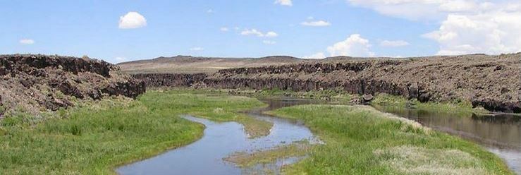
In 2003, CNHP received funding from the Colorado Department of Natural Resources (CDNR) through a grant from EPA Region 8 to survey critical wetlands within southern Alamosa and Costilla counties. Results of this project confirm that southern Alamosa and Costilla counties contain areas with high biological significance and a diverse array of wetlands that support a wide variety of plants, animals, and plant associations. At least 26 major wetland/riparian plant communities, six birds, one fish, and one plant from CNHP's Tracking List are known to occur in, or associated with, wetlands in southern Alamosa and Costilla counties. Seventeen wetland and riparian PCAs were documented. Of the 17, two sites were deemed nearly irreplaceable (B2) and 13 were of high biodiversity significance (B3). Of particular importance, the Rio Grande at Alamosa National Wildlife Refuge PCA supports populations of the Federally Endangered Southwestern Willow Flycatcher (Empidonax traillii extimus) while the Hansen Bluffs Seeps Potential Conservation Area (B3) supports a fen occurring at an uncharacteristically low elevation.
To view the full report, click here.
Delta County
1997
Natural Heritage Biological Survey of Delta County, Colorado
Peggy Lyon and Earl Williams
In 1997, CNHP received funding from Great Outdoors Colorado (GOCO) to survey critical biological resources in Delta County to assist the Delta County Commissioners with prioritizing conservation opportunities under the County Master Plan. Field surveys began in April, 1997, and continued through November, 1997. Two hundred thirty-three element occurrences were new or updated and one plant, Arizona centaury (Centaurium arizonicum), was documented for the first time in Colorado. Results of the survey confirm that, due to unusual geological and soil substrates, Delta County contains a number of plant species endemic to western Colorado which depend on the county for their existence. The clay-loving wild buckwheat (Eriogonum pelinophilum) is one of the globally rare, endemic plants dependent on Delta County. Riparian zones and salt desert shrublands were found to be the most locally threatened common communities and several plants and animals were found to be more common than had been thought. CNHP identified 44 PCAs containing 181 element occurrences of rare or imperiled plants, animals, and natural plant communities.

To view the full report, click here.
Denver County
2013
Survey and Assessment of Critical Urban Wetlands: City and County of Denver
Pam Smith and Bernadette Kuhn
Denver County is located in the South Platte River Basin and is the most highly developed and densely populated area in the region. Wetlands in dense urban centers differ from natural systems, but they perform critical functions such as providing wildlife habitat and storm water retention. For the 2013 Denver County survey, CNHP updated National Wetland Inventory (NWI) maps in Denver County and assessed wetland condition for nearly all publicly managed wetlands. Wetland extent and condition were largely unknown prior to the survey. NWI maps showed that only 2.5% of Denver County was mapped as wetlands or waterbodies. All of the wetlands surveyed were found to provide important functions and are worthy of protection efforts because of ecological and social value to the community. Additionally, 24 new county records for vascular plants were documented, as well as new and updated occurrences of three rare plant species. Rare plants in the county include sweetflag (Acorus calamus), broadfruit bur-reed (Sparganium eurycarpum), and plains ragweed (Ambrosia linearis).

To view the full report, click here.
Dolores County
2004
Survey of Critical Wetlands and Riparian Areas in Dolores County
Maggie March, Denise Culver, Peggy Lyon, Julia Hanson and Sarah Eastin
In 2004, CNHP received funding from the Colorado Department of Natural Resources (CDNR) through a grant from EPA Region 8, to survey for critical wetlands within Dolores County as part of a statewide effort to identify significant wetland habitat. Results of the wetland and riparian survey confirm that Dolores County contains wetland areas with high biological significance and a diverse array of wetland types that support at least 35 major wetland/riparian plant communities, three plants, three birds, and one fish from CNHP's Tracking List. The results from the survey yielded 25 wetland and riparian PCAs. Two PCAs were of very high biodiversity significance (B2), and 13 are of high biodiversity significance (B3). Several PCAs supported large, intact wetlands dominated by sheep sedge (Carex illota), which is a fen indicator. Other PCAs supported extensive beaver enhanced willow wetlands throughout the higher elevations.

To view the full report, click here.
Douglas County
1994
Natural Heritage Resources of Douglas County and their Conservation
Chris Pague, Aaron Ellingson, Steve Kettler, Susan Spackman, Julie Burt and Kevin Essington
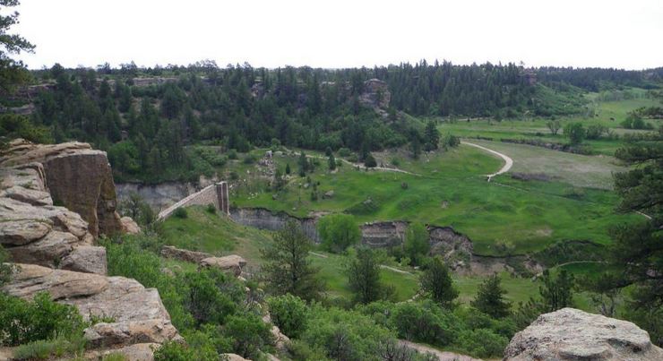
In 1993, CNHP was contracted by the Douglas County Department of Planning and Community Development to assess and prioritize lands of ecological value in the county. The inventory was conducted in several steps, with field surveys occurring in 1994. Thirty-one rare plants and animal species, and three significant natural plant communities were documented. Of global significance was the documentation of Preble's meadow jumping mouse (Zapus hudsonius preblei) at several sites and a Parry's oatgrass grassland found on several scenic buttes. Nineteen PCAs were identified with several ranked as globally significant.
To view the full report, click here.
Eagle County
1999
Biological Survey of Eagle County, Colorado
Kim Fayette, Mike Wunder and Scott Schneider
Eagle County is marked by high montane habitats bordered by the Sawatch Range to the south, the Gore Range to the east, and the Flat Tops to the west. Fourteen priority species of plants, three of mammals, 11 of birds, two of fishes, one amphibian and one invertebrate species, and 53 significant natural plant communities were documented during the survey. Of greatest overall significance is the preponderance of Harrington's beardtongue (Penstemon harringtonii). Eagle County maintains the heart of the distribution. Additionally, the boreal toad occurrences in Eagle County are extremely noteworthy and Deep Creek is a pristine and intact landscape that supports a healthy cross section of unique plant communities. CNHP identified 40 PCAs containing 53 of the 86 elements documented from Eagle County. Five PCAs were ranked as very significant (B2) and 22 as significant (B3).

To view the full report, click here.
El Paso County
2000
Survey of Critical Biological Resources in El Paso County, Colorado
Georgia Doyle, John Armstrong, Jim Gionfriddo, Dave Anderson, Joe Stevens and Robert Schorr
The 2000 surveys of El Paso County consisted of two distinct projects, one covering all disciplines and one with a wetland/riparian focus that extended south into Pueblo County. This report covers all rare plants, animals, and plant communities of biological importance in El Paso County. Results of the survey confirm that there are many areas with high biological significance. Altogether, 24 rare or imperiled plant species, 25 rare or imperiled animal species, and 47 plant communities of concern were documented. CNHP identified 40 PCAs. Two are irreplaceable (B1) and 11 are of very high biodiversity significance (B2). Of particular interest are rare plants that are unique to Pikes Peak; a Preble’s meadow jumping mouse population along Monument Creek and its tributaries; a native historic population of greenback cutthroat trout in Severy Creek; tallgrass prairie remnants near Colorado Springs Airport; Mountain Plover and playa communities in southeastern El Paso County; foothills communities at Aiken Canyon and Cheyenne Mountain; native historic populations of Arkansas darter in Big Sandy and Black Squirrel creeks, and large intact sandsage prairie communities at Signal Rock Sandhills.

To view the full report, click here.
Survey of Critical Wetlands and Riparian Areas in El Paso and Pueblo Counties, Colorado
Georgia Doyle, Jim Gionfriddo, Dave Anderson and Denise Culver
The 2000 surveys of El Paso County consisted of two distinct projects, one covering all disciplines and one with a wetland/riparian focus that extended south into Pueblo County. This report focuses on biologically important wetland and riparian areas in El Paso and Pueblo counties. Results of the survey confirm that El Paso and Pueblo counties contain areas with high biological significance and a diverse array of wetlands. Twenty-five wetland and riparian PCAs were delineated in the two counties. Of these sites, seven were of very high significance (B2), and 10 were of high significance (B3). One of the most biologically significant sites in El Paso County is the Buffalo Playas site, with over 300 playas that support a rare plant, plains ambrosia (Ambrosia linearis), and a rare buffalograss playa community. Most of the playas were in good condition. Also of very high biodiversity significance is the riparian vegetation along Monument Creek which supports a healthy population of the Preble's meadow jumping mouse (Zapus hudsonius preblei).

To view the full report, click here.
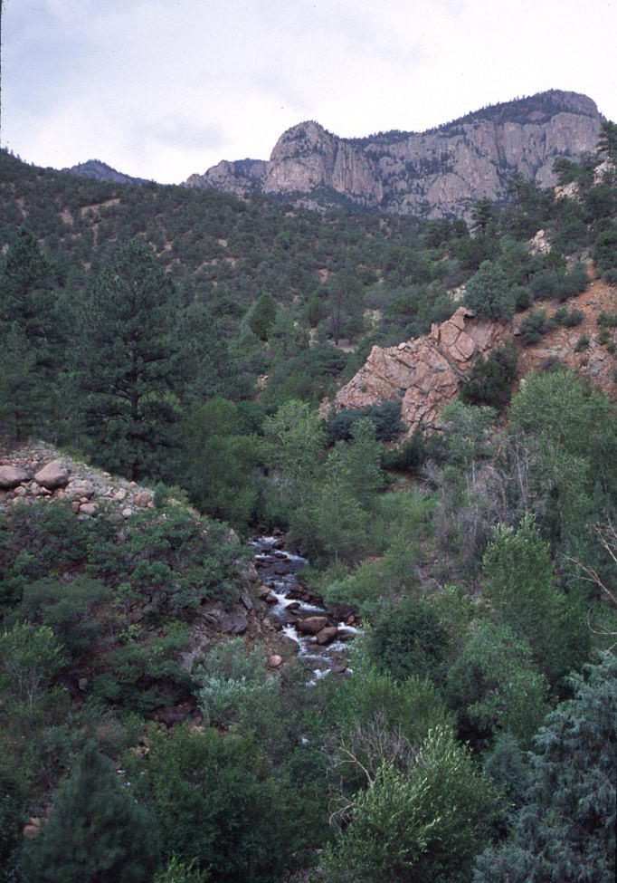
In 2004, CNHP was awarded funds from the Colorado Department of Natural Resources via a grant from EPA Region 8 to survey critical wetlands and riparian areas in Fremont County, Colorado. With additional assistance from the BLM and Colorado Parks and Wildlife, 80% of the targeted inventory areas were evaluated during the summer of 2005. In total, 27 new occurrences of globally vulnerable or globally imperiled wetland natural communities were assessed. These occurrences span the wide range of elevation in Fremont County from plains, barrens, and foothills to montane, subalpine, and alpine zones. Twenty-one known natural community occurrences documented in the mid- to late 1990s were re-visited and re-assessed; several on BLM lands showed positive ecological improvements as a result of land management changes. One new rare wetland plant population of the globally imperiled pale blue-eyed grass (Sisyrinchium pallidum) was discovered during the 2005 field season.
To view the full report, click here.
Garfield County
2015
Survey of Critical Biological Resources: A Resurvey and Update of Potential Conservation Areas in Garfield County, Colorado
Delia Malone, John Emerick, Peggy Lyon, Jill Handwerk, John Sovell and Bernadette Kuhn
In 2015, CNHP was contacted by Garfield County to update the 2000 biological survey. A subset of 27 PCAs were selected for survey and results were varied. The ecological condition of some sites was still functional, while others are undergoing ecological decline due to increased stresses such as noxious weed invasion or incompatible livestock grazing. The 2015 survey resulted in 76 new element occurrences, including some species that were new to the county. Plant species newly documented in Garfield County included Sego cisco lily (Calochortus ciscoensis), good-neighbor bladderpod (Physaria vicina), mud sedge (Carex limosa), and least moonwort (Botrychium simplex). Animal species newly documented in the county included Western Yellow-billed Cuckoo (Coccyzus americanus occidentalis) and Northern Pygmy Owl (Glaucidium gnoma).

To view the full report, click here.
2000
Survey of Critical Biological Resources in Garfield County, Colorado
Peggy Lyon, John Sovell and Joe Rocchio
The 2000 surveys of Garfield County consisted of two distinct projects, one covering all disciplines and one with a wetland/riparian focus. This report covers all rare plants, animals, and plant communities of biological importance in the county. Field surveys began in April 2000 and continued through September, 2000. Results of the survey confirm that Garfield County contains areas with high biological significance. Of particular importance are plants, like Parachute penstemon (Penstemon debilis), that are unique to the Green River shale of the Roan Plateau and Bookcliff areas. Altogether, 30 rare or imperiled plant species, 33 animal species, and 75 plant communities of concern have been documented for Garfield County. CNHP identified 73 PCAs, one with outstanding biodiversity significance (B1) and 12 with very high biodiversity significance (B2).

To view the full report, click here.
Survey of Critical Wetlands and Riparian Areas in Garfield County
Joe Rocchio, Peggy Lyon and John Sovell
The 2000 surveys of Garfield County consisted of two distinct projects, one covering all disciplines and one with a wetland/riparian focus. This report focuses on biologically important wetland and riparian areas in the county. Wetland survey efforts in Garfield County identified many areas worthy of global and regional significance. East Rifle Creek, especially within Rifle Mountain Park, and East Elk Creek are a few examples. Both of these areas support healthy, globally rare, diverse riparian communities in addition to unique spring and hanging garden wetlands. One of the riparian communities along the Colorado River is considered to be globally imperiled (Populus fremontii/Rhus trilobata). One of most significant wetland resources thus far identified in Garfield County is the numerous seeps and springs scattered throughout the county. Most of Garfield County is extremely arid, thus the presence of periodic areas of wetland and open water habitat provide a critical element to landscape diversity in this portion of western Colorado.

To view the full report, click here.
Gilpin County
2009
Survey of Critical Wetlands of Gilpin County Colorado
Delia Malone, Joe Stevens and Denise Culver
The 2009 survey of critical wetlands in Gilpin County was conducted to identify the locations and condition of vulnerable riparian and geographically isolated wetland resources within the county. Funding for the project was provided by EPA Region 8. The main outcome of the project was a map and assessment of the condition of wetlands in the South Platte watershed within Gilpin County. The assessment of wetlands in this project identified the highest quality and most threatened wetland resources for protection. Ancillary to this process, the survey efforts also identified those wetlands in need of restoration to improve wetland condition. Federal, state, local, and private, and non-profit partners can use these assessments to target protection and/or restoration efforts. The survey documented 14 PCAs with significant wetland or riparian resources, one with very high biodiversity significance (B2) and five with high biodiversity significance (B3). The Mammoth Gulch PCA is ranked very high (B2) due to the presence of a good quality occurrence of a rare iron fen ((Picea engelmannii) / Betula nana / Carex aquatilis - Sphagnum angustifolium Woodland).

To view the full report, click here.
Grand County
2005
Survey of Critical Biological Resources in Grand County, Colorado
Denise Culver and Jennifer Jones
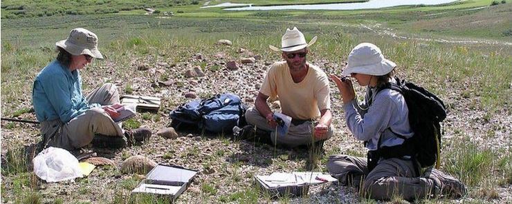
In 2005, CNHP surveyed Grand County with support from Great Outdoors Colorado and Grand County Department of Natural Resources. Grand County is a place of tremendous beauty whose economy over the years has steadily changed from agriculture to tourism. The survey prioritized field efforts on rare, sensitive, and unique plants and plant communities. CNHP documented expansions of the known range for the federally listed Endangered plants Osterhout’s milkvetch (Astragalus osterhoutii) and Penland’s beardtongue (Penstemon penlandii), as well as other rare plants. Two county records resulted from the field surveys – dropleaf buckwheat (Eriogonum exilifolium), a globally imperiled plant, and three-tip sagebrush (Artemisia tripartita), previously not documented on the West Slope. One of the most valuable outcomes of the project was the active involvement of the advisory council formed by CNHP as part of the project. The enthusiastic involvement of the council was a major factor in accessing private properties. The importance of community-based conservation cannot be overstated. Field surveys are the first step in the protection of biological resources. The advisory council will ensure that the data will be incorporated into ongoing, community-based open space planning. Project data provide the advisory council and Grand County with baseline information needed to make informed land use decisions, maximizing the consideration of biological diversity in the planning process.
To view the full report, click here.
Gunnison County
2002
Survey of Critical Wetlands and Riparian Areas in Gunnison County
Joe Rocchio, Georgia Doyle and Renée Rondeau
In 2002, CNHP was awarded funds from the Colorado Department of Natural Resources via a grant from EPA Region 8 to survey critical wetlands and riparian areas in Gunnison County. High quality examples of wetlands and riparian areas and those supporting populations of rare wetland-dependent species were given highest priority. Results of the wetland and riparian survey confirm that Gunnison County contains areas with high biological significance and a diverse array of wetlands that support a wide variety of plants, animals, and plant associations. At least 49 major wetland/riparian plant communities, 10 plants, four birds, one fish, one amphibian, and two invertebrates from CNHP's Tracking List are known to occur in, or associated with, wetlands in Gunnison County. CNHP identified 40 wetland and riparian PCAs, including six of very high biodiversity significance (B2) and 31 of high biodiversity significance (B3). Of these PCAs, several stand out as very significant, such as the Cement Creek Potential Conservation Area. This PCA harbors the first documented occurrence of an extreme rich fen outside of South Park in Colorado. Extreme rich fens are unique wetland types only found in a few locations in the Western Hemisphere. Three other PCAs harbor another unique wetland type, iron fens. Iron fens are very unique due to their water chemistry which supports a flora very typical of poor fens and true bogs. Additionally, Triangle Pass supports one of the best known breeding locations for the critically imperiled boreal toad in Colorado. In addition to supporting interesting and rare wetland types, Gunnison County and the Gunnison Basin support the best remaining population of Gunnison Sage Grouse, a critically imperiled and declining species.

To view the full report, click here.
Hinsdale County
2006/2007
Survey of Critical Wetlands and Riparian Areas in Hinsdale County, Colorado
Stephanie Neid and Jennifer Jones
In 2005, CNHP was awarded funds from the Colorado Department of Natural Resources via a grant from EPA Region 8 to survey critical wetlands and riparian areas in Hinsdale County. With additional assistance from the BLM, USFS and CPW, sixty percent of the 138 targeted inventory areas were assessed during the summer of 2006. A second field season in 2007 was funded by the BLM in which 55 additional sites of seeps and springs were evaluated. In total, 21 new occurrences of globally vulnerable or globally imperiled wetland natural communities were assessed, several of which are unique iron fens. There are concentrations of rare fen wetlands in Hinsdale County due to its relatively high elevation. Nine known natural community occurrences documented in the mid- to late 1990’s were re-visited and re-assessed. One new rare wetland plant population of the globally vulnerable Altai cottongrass (Eriophorum altaicum var. neogaeum) was discovered during the 2006 field season and another known occurrence was revisited. Results of the survey confirm that there are many wetland and riparian areas with high biological significance. Altogether, one amphibian, two birds, three fish, one mollusk, 45 wetland or riparian communities, and one imperiled wetland plant species on CNHP's Tracking List are known from Hinsdale County. CNHP identified 37 wetland and riparian PCAs, 10 with very high biodiversity significance (B2). These areas can guide planning efforts and identify unique areas of wetland biodiversity within Hinsdale County. Data also facilitates conservation action planning implemented by the Lake Fork Watershed Stakeholders.

To view the full report, click here.
Huerfano County
2015/2016
Survey of Critical Wetland Resources in Huerfano County, Colorado
Denise Culver and Pam Smith
In 2015 and 2016, CNHP conducted field surveys for critical wetlands in Huerfano County. Results of the survey confirm that there are many wetland and riparian areas with high biological significance in Huerfano County. The importance of wetlands in the county cannot be overstated. They constitute less than 3% of the total landscape, yet are essential to wildlife and agriculture and support a number of rare plants and animals. CNHP documented two important wetland types: fens, which are peat-accumulating wetlands that are several thousand years old, and playas, ephemeral wetlands that support migratory birds, wildlife, and humans. Altogether, four rare or imperiled species and 11 wetland plant communities of concern were documented in Huerfano County. Fourteen new county records were documented and deposited in the Colorado State University Herbarium. CNHP identified 21 PCAs that represent both wetland and upland sites. Three are of very high biodiversity significance (B2) and 10 are of high significance (B3).

To view the full report, click here.
Jackson County
2009
Identification and Assessment of Important Wetlands within the North Platte River Watershed
Denise Culver, Karin Decker, John Sovell, Jodie Bell, Janis Huggins and Jessica Parker
In 2009, CNHP conducted field surveys for critical wetlands in Jackson County. Due to the sparse wetland information in the watershed, the survey focused on private lands. Site visits resulted in 68 new element occurrences. New information was combined with existing data to delineate 32 PCAs, one of very high biodiversity significance (B2) and 22 of high biodiversity significance (B3). The diversity of wetland and riparian communities found in the North Platte Watershed affords the citizens of Colorado some of the most extensive habitat for waterfowl, shorebirds and aquatic mammals. Additionally, three PCAs contain floating mat fens (peat accumulating wetlands) that support numerous rare sedges and three PCAs are the only known Colorado sites that support all three montane amphibians: the boreal toad (Bufo boreas boreas), the northern leopard frog, (Rana pipiens) and the wood frog (Rana sylvatica).

To view the full report, click here.
Jefferson County
2010
Survey of Critical Biological Resources in Jefferson County, Colorado
John Sovell, Pam Smith, Denise Culver, Susan Panjabi and Joe Stevens
At the end of the 2010 survey, there were 35 rare plant species, 11 rare animal species, one fungus, and 29 wetland and upland plant communities of concern documented in Jefferson County. Two plants and one fungus were State records. They are openfield sedge (Carex conoidea) from Turkey Creek at Aspen Park, the hybrid twinpod (Physaria x 1) from the Ken Caryl Hogbacks, and a new subspecies of an earthstar fungus (Mycenastrum corium ssp. ferrugineum) from Prospect Park. CNHP identified 46 PCAs in Jefferson County. The two PCAs ranked with outstanding biodiversity significance (B1) include the South Platte River Valley and Hankins Gulch PCAs, which achieve B1 ranks due to the presence of globally critically imperiled element occurrences that are in excellent (A ranked) condition. These elements are the Pawnee montane skipper butterfly (Hesperia leonardus montana) and Rocky Mountain monkeyflower (Mimulus gemmiparus), respectively.

To view the full report, click here.
1993
Natural Heritage Inventory of Jefferson County, Colorado
Christopher Pague, Renée Rondeau and Mark Duff
In 1992, CNHP was contracted by Jefferson County Open Space to conduct an inventory of potential natural areas within the county. The goal was to systematically identify localities containing natural heritage resources. At the completion of the survey, CNHP recorded two rare vertebrate species, six rare invertebrate species, 10 rare plant species, and 17 natural communities of statewide significance in Jefferson County. Two rare plants were found to be more common than previously thought. CNHP mapped 27 PCAs that considered habitat for rare species, protection of water quality, buffers from disturbance, and the maintenance of ecological processes necessary to sustain significant elements of biodiversity.

To view the full report, click here.
La Plata County
2003
Assessment of Critical Biological Resources in La Plata County, Colorado
Peggy Lyon, Janis Huggins, Joseph Lucht, Denise Culver, Maggie March and Julia Hanson
The 2003 La Plata County surveys consisted of two distinct projects, one covering all disciplines and one with a wetland/riparian focus. This report covers all rare plants, animals, and plant communities of biological importance in the county. CNHP began work in the spring of 2003 by compiling existing data and selecting areas to be inventoried during the field season. Fieldwork was completed from mid-June through September 2003. One hundred thirty new or updated occurrences of plants, animals and natural communities were documented and evaluated, leading to the identification of 68 PCAs. Along its border with New Mexico, the county has habitat for the critically imperiled Knowlton's cactus (Pediocactus knowltonii) which has only been found in northern New Mexico.

To view the full report, click here.
Survey of Critical Wetlands and Riparian Areas in La Plata County
Maggie March, Peggy Lyon, Denise Culver and Janis Huggins
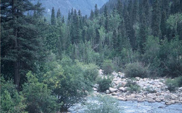
The 2003 La Plata County surveys consisted of two distinct projects, one covering all disciplines and one with a wetland/riparian focus. This report focuses on biologically important wetland and riparian areas in the county. Field surveys began in June 2003 and continued through September 2003. High quality examples of wetlands and riparian areas and those supporting populations of rare wetland-dependent species were given highest priority. Results of the wetland and riparian survey confirm that La Plata County contains areas with high biological significance and a diverse array of wetlands that support a wide variety of plants, animals, and plant associations. At least 32 major wetland/riparian plant communities, nine plants, one bird, and two fish from CNHP's Tracking List are known to occur in, or associated with, wetlands in La Plata County. Thirty-four wetland and riparian PCAs are profiled in this report. These PCAs represent the best examples of wetland and riparian communities observed on the private and public lands visited. Of the PCAs, several stand out as very significant, such as the riparian plant community white fir – blue spruce - narrowleaf cottonwood / Rocky Mountain maple (Abies concolor – Picea pungens – Populus angustifolia / Acer glabrum) occurring at Elbert Creek, Madden Creek and Junction Creek sites. Another significant site in La Plata County is the wetlands at Haviland Lake. This site supports diverse vegetation structure, including emergent sedge wetlands, bog birch (Betula glandulosa) / mesic graminoid – mesic forbs plant community and several imperiled plant species.
To view the full report, click here.
Lake County
2017/2018
Survey of Critical Biological Resources in Lake County, Colorado
Denise Culver and Pamela Smith
In 2017 and 2018, CNHP surveyed Lake County for wetland and upland critical biological resources. Results of the survey demonstrate the high diversity of species and plant communities, ranging from alpine tundra to montane grassland, and substantiate the county’s importance to the biodiversity of Colorado and the world. Over 9% of the county is wetlands, compared to 2-3% of the state overall, and while Lake County covers less than 1% of Colorado, it supports 40% of the plant species known from the state. It also supports 17 plant species known only from Colorado or the surrounding region, and provides habitat for the globally imperiled boreal toad. During the survey, the first known extreme rich fen west of the Mosquito Range was documented. CNHP identified 24 PCAs, one of outstanding biodiversity significance, seven of very high biodiversity significance, twelve of high biodiversity significance and four of moderate biodiversity significance. Lake County is truly unique with an amazing richness of fauna and flora well worth preserving for future generations.

To view the full report, click here.
Larimer County
2004
Survey of Critical Biological Resources in Larimer County, Colorado
Georgia Doyle, Stephanie Neid and Renée Rondeau
In 2004, Larimer County and the cities of Fort Collins and Loveland requested that CNHP survey for critical biological resources to supplement a biological survey conducted by CNHP in 1996. As in 1996, the goal of the project was to systematically identify the locations of rare species and significant natural plant communities in Larimer County, and to identify and prioritize areas of critical habitat (PCAs) for these species and communities. Additional goals of the 2004 project were to help assess the biological integrity on specific lands under consideration for conservation action, update data on existing protected open space properties, and provide data for development review purposes through the Larimer County Planning Department. Results of the survey confirm that there are many areas with high biological significance in Larimer County. There are several extremely rare plants and animals that depend on these areas for survival. All together, 71 rare plant species, 48 rare animal species (24 vertebrate and 24 invertebrate), and 94 plant communities of concern have been documented in the county. Of particular interest are intact shortgrass prairie and foothills communities in the northeastern corner of the county, newly documented locations of the rare plant Bell’s twinpod (Physaria bellii), new discoveries of rare plants on shale outcrops in the Laramie River Valley (including a state record), newly discovered breeding locations for the rare boreal toad (Bufo boreas), newly documented ponderosa pine woodlands, a stonefly known only from Larimer County, and Preble’s meadow jumping mouse populations along three major drainages. As part of this project, 98 new element occurrences were created and 74 were updated. Sixty-seven PCAs are highlighted in the report, two of which are deemed irreplaceable (B1).

To view the full report, click here.
1996
Significant Plant, Animal, and Wetland Resources of Larimer County and Their Conservation
Steve Kettler, John Sanderson, Susan Spackman, Kim Fayette, Chris Pague, Dina Clark and Andrew Hicks
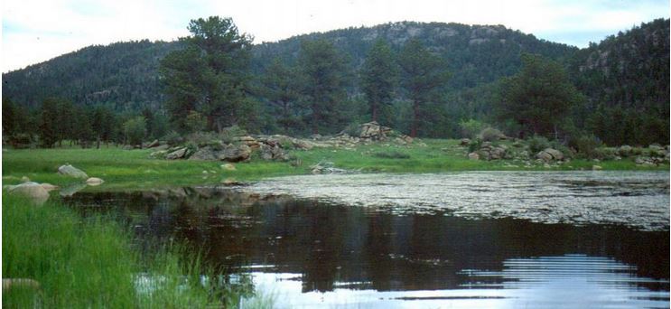
In 1996, CNHP was contracted to assess the natural heritage values of lands throughout Larimer County. The primary goal of this project was to identify locations in Larimer County with natural heritage significance. Field surveys took place from April 1996 through October 1996. Over 150 rare plant and animal species, and significant natural communities have been documented in Larimer County. Seven rare plants are particularly significant because they are considered to be imperiled not only in Colorado, but throughout their ranges. These include Bell’s twinpod (Physaria bellii), Larimer aletes (Aletes humilis), Rocky Mountain cinquefoil (Potentilla effusa var. rupincola), Ute Ladies’ tresses orchid (Spiranthes diluvialis), Colorado butterfly plant (Gaura neomexicana ssp. coloradensis), and pale blue-eyed grass (Sisyrinchium pallidum). Additionally, CNHP identified 73 PCAs, of which 27 support wetland and riparian communities. The wetland and riparian surveys documented several highly functional and biologically significant wetlands. The Lake Pasture PCA contains an unusual and likely globally imperiled wetland. The site supports several wetland plant communities in excellent to good condition. The site is now under a conservation easement due in part to this project.
To view the full report, click here.
Las Animas County
Survey of Critical Biological Resources, Southeastern Colorado
2007/2008
Joe Stevens, John Sovell, Denise Culver, Karin Decker, Lee Grunau, Amy Lavender and Chris Gaughan
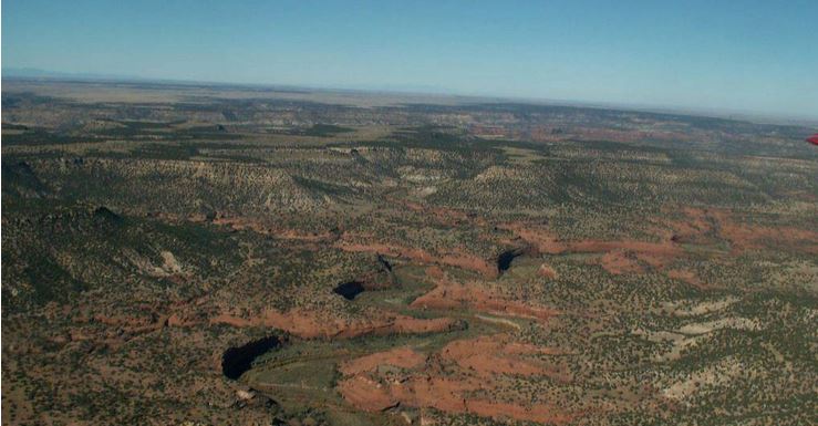
In southeast Colorado, the Purgatory River has cut an intricate network of deep sandstone canyons into the vast shortgrass prairie. This unique area includes Colorado’s largest remaining expanses of shortgrass prairie as well as the most extensive juniper woodland-savanna in the western Great Plains. The 2007-2008 survey of southeastern Colorado included over 2 million acres of land surrounding the Department of Defense Pinon Canyon Maneuver Site, much of which is privately owned ranch land. Working directly with the Colorado Cattlemen’s Agricultural Land Trust, Great Outdoors Colorado, and other funders, we conducted inventory on approximately 800,000 acres in order to document the rare plants, animals, and natural communities in this diverse landscape. Central Las Animas County, southern Otero County, and small portions of Bent and Pueblo County were targeted. CNHP collected 120 animal, 71 plant, and eight natural community element occurrence locations which confirms that the area is biologically diverse and supports a high quality and well-functioning ecosystem. Among the unexpected and exciting observations made during the inventory were occurrences of the James’ penstemon (Penstemon jamesii), a species not observed from the area since the 1940’s; numerous occurrences for the wheel milkweed (Asclepias uncialis ssp. uncialis), occurring in small colonies scattered along the eastern edge of the southern Rocky Mountains; and many new locations of the triploid checkered whiptail (Cnemidophorus neotesselatus), a state species of special concern. CNHP also delineated 34 PCAs, nine of which are of very high biodiversity significance (B2).
To view the full report, click here.
Mesa County
2001
Survey of Critical Wetlands and Riparian Areas in Mesa County
Joe Rocchio, Georgia Doyle, Peggy Lyon and Denise Culver
In 2001, CNHP received funding from the Colorado Division of Wildlife Wetlands Program to survey for critical wetlands within Mesa County. The goal of the project was to systematically identify the localities of rare, threatened, or endangered species dependent on wetland and riparian areas and the locations of significant natural wetland and riparian plant communities. At least 34 major wetland/riparian plant communities, eight plants, nine birds, six fish, three amphibians, and two invertebrates from CNHP's Tracking List are known to occur in, or associated with, wetlands in Mesa County. This wetland survey documented 32 PCAs. Two were deemed irreplaceable or with outstanding biodiversity significance (B1) and 12 as very high biodiversity significance (B2). The B1 sites included several sections of the Colorado River with good occurrences of Rio Grande cottonwood/skunkbush (Populus deltoides ssp. wislizeni/ Rhus trilobata) a globally imperiled riparian plant community.

To view the full report, click here.
1996
Natural Heritage Inventory of Mesa County, Colorado
Peggy Lyon, Chris Pague, Renée Rondeau, Lonnie Renner, Charles Slater and Camille Richard
In 1995, The Nature Conservancy proposed to the Mesa County Commissioners that a natural heritage inventory for Mesa County be conducted by CNHP. Field work began in April 1996 and continued through October 1996. Results of the survey confirmed that Mesa County contains an extremely high number of endemic species due to unusual geology and soil substrates. One such species is the globally rare Dolores River skeletonplant (Lygodesmia doloresensis). Mesa County also represents the northern or western limits for many animals. CNHP identified 78 PCAs containing 620 occurrences of rare or imperiled plants, animals, and natural communities. Two hundred thirty-five occurrences were new. Several plants and animals were found to be more common than had been thought. Riparian areas and native bunchgrasses were found to be the most threatened common communities.

To view the full report, click here.
Mineral County
1998
Biological Survey of Mineral County, Colorado
Renée Rondeau
In 1998, CNHP surveyed Mineral County as part of an ongoing inventory of Colorado counties within the San Luis Valley. Funding was provided by Great Outdoors Colorado and The Nature Conservancy. The inventory documented 63 biologically significant elements, including 19 plants, 28 plant communities, two mammals, six birds, three fish, two amphibians, and three invertebrates. Mineral County was found to be very important, and possibly the center of distribution for three rare plants: Smith whitlow-grass (Draba smithii), Black canyon gilia (Gilia penstemonoides), and Southern Rocky Mountain cinquefoil (Potentilla ambigens). Over twenty PCAs were identified, with several standing out as very significant (B2), including Bellows Creek, North Creede, Deep Creek Uplands, Antelope Park, and Rat Creek Pond.

To view the full report, click here.
San Miguel County and western Montrose County were collectively surveyed from April 1999 through November 1999. Results of the survey confirm that San Miguel and western Montrose counties contain areas with high biological significance. The riparian zones of the San Miguel and Dolores River are outstanding when viewed at a global scale. There are several extremely rare plants and animals that depend on this area for the survival of their species. Conversely, as a result of this survey, some plants and animals were found to be more common than had been thought. Forty-four rare or imperiled plant species, 24 animal species, and 50 plant communities of concern have been documented in counties. Of these, 15 plant species, nine animal species, and 11 plant communities were recorded for the first time in the CNHP database for the area. CNHP identified 59 PCAs, containing 338 occurrences of rare or imperiled plants, animals, and natural communities.

To view the full report, click here.
1998
A Natural Heritage Assessment of the Uncompahgre River Basin (Eastern Montrose and Ouray Counties)
Peggy Lyon, Tom Stephens, Jeremy Siemers, Denise Culver, Phyllis Pineda and Jennifer Zoerner
The 1998 Uncompahgre River Basin surveys consisted of two distinct projects, one covering all disciplines and one with a wetland/riparian focus. This report covers all rare plants, animals, and plant communities of biological importance in the basin. Field surveys began in April 1998 and continued through November 1998. Results of the survey confirm that the Uncompahgre Basin contains a number of plant species endemic to western Colorado. Due to unusual geological and soil substrates, the world’s population of several species is restricted to a relatively small geographic area. We found that riparian zones and salt desert shrublands are the most locally threatened plant communities. Several plants and animals were found to be more common than had been thought. CNHP identified 65 PCAs, containing 254 occurrences of rare or imperiled plants, animals, and natural communities.

To view the full report, click here.
A Natural Heritage Assessment of Wetlands and Riparian Areas in the Uncompahgre River Basin (Eastern Montrose and Ouray Counties)
Thomas Stephens, Denise Culver, Jennifer Zoerner and Peggy Lyon
The 1998 Uncompahgre River Basin surveys consisted of two distinct projects, one covering all disciplines and one with a wetland/riparian focus. This report focuses on biologically important wetland and riparian areas in the basin. The Uncompahgre River Basin contains a diverse array of wetlands that support a wide variety of wetland dependent plants, animals, and plant communities. Several PCAs along the Uncompahgre River support globally rare riparian plant communities in excellent to good condition. Ironton Park, in Ouray County, contains an iron fen, a unique wetland type that has a low pH, much like a bog in the boreal parts of North America.

To view the full report, click here.
Otero County
Survey of Critical Biological Resources, Southeastern Colorado
2007/2008
Joe Stevens, John Sovell, Denise Culver, Karin Decker, Lee Grunau, Amy Lavender and Chris Gaughan
In southeast Colorado, the Purgatory River has cut an intricate network of deep sandstone canyons into the vast shortgrass prairie. This unique area includes Colorado’s largest remaining expanses of shortgrass prairie as well as the most extensive juniper woodland-savanna in the western Great Plains. The 2007-2008 survey of southeastern Colorado included over 2 million acres of land surrounding the Department of Defense Pinon Canyon Maneuver Site, much of which is privately owned ranch land. Working directly with the Colorado Cattlemen’s Agricultural Land Trust, Great Outdoors Colorado, and other funders, we conducted inventory on approximately 800,000 acres in order to document the rare plants, animals, and natural communities in this diverse landscape. Central Las Animas County, southern Otero County, and small portions of Bent and Pueblo County were targeted. CNHP collected 120 animal, 71 plant, and eight natural community element occurrence locations which confirms that the area is biologically diverse and supports a high quality and well-functioning ecosystem. Among the unexpected and exciting observations made during the inventory were occurrences of the James’ penstemon (Penstemon jamesii), a species not observed from the area since the 1940’s; numerous occurrences for the wheel milkweed (Asclepias uncialis ssp. uncialis), occurring in small colonies scattered along the eastern edge of the southern Rocky Mountains; and many new locations of the triploid checkered whiptail (Cnemidophorus neotesselatus), a state species of special concern. CNHP also delineated 34 PCAs, nine of which are of very high biodiversity significance (B2).

To view the full report, click here.
Ouray County
1998
A Natural Heritage Assessment of the Uncompahgre River Basin (Eastern Montrose and Ouray Counties)
Peggy Lyon, Tom Stephens, Jeremy Siemers, Denise Culver, Phyllis Pineda and Jennifer Zoerner
The 1998 Uncompahgre River Basin surveys consisted of two distinct projects, one covering all disciplines and one with a riparian/wetland focus. This report covers all rare plants, animals, and plant communities of biological importance in the basin. Field surveys began in April 1998 and continued through November 1998. Results of the survey confirm that the Uncompahgre Basin contains a number of plant species endemic to western Colorado. Due to unusual geological and soil substrates, the world’s population of several species is restricted to a relatively small geographic area. We found that riparian zones and salt desert shrublands are the most locally threatened plant communities. Several plants and animals were found to be more common than had been thought. CNHP identified 65 PCAs, containing 254 occurrences of rare or imperiled plants, animals, and natural communities.

To view the full report, click here.
A Natural Heritage Assessment of Wetlands and Riparian Areas in the Uncompahgre River Basin (Eastern Montrose and Ouray Counties)
Thomas Stephens, Denise Culver, Jennifer Zoerner and Peggy Lyon
The 1998 Uncompahgre River Basin surveys consisted of two distinct projects, one covering all disciplines and one with a riparian/wetland focus. This report focuses on biologically important wetland and riparian areas in the basin. The Uncompahgre River Basin contains a diverse array of wetlands that support a wide variety of wetland dependent plants, animals, and plant communities. Several Potential Conservation Areas along the Uncompahgre River support globally rare riparian plant communities in excellent to good condition. Ironton Park, in Ouray County, contains an iron fen, a unique wetland type that has a low pH, much like a bog in the boreal parts of North America.

To view the full report, click here.
Park County
2000
Park County Inventory of Critical Biological Resources
Susan Spackman, Denise Culver and John Sanderson
In 2000-2001, CNHP received funds from Denver Water, the City of Aurora, Colorado Division of Wildlife, Center of Colorado Water Conservancy District, Park County Land and Water Trust Fund, EPA and the U.S. Forest Service to conduct an inventory of the critical biological resources found in Park County. The primary goal of this project was to identify the locations in Park County with natural heritage significance (places where rare or imperiled plants, animals, or plant communities have been documented). Over 115 rare or imperiled plant species, animal species, and significant plant communities have been documented in Park County. About 50 of these natural heritage elements are globally significant, while the rest have state-wide significance. CNHP described and prioritized 35 PCAs in the county based on survey results. Of particular importance, the vegetation on the floor of South Park is dominated by a globally rare grassland composed primarily of Arizona fescue (Festuca arizonica) and slimstem muhly (Muhlenbergia filiculmis). In addition, the wetlands of South Park are comparable to few others found in the world. The geologic and hydrologic setting found in South Park combines to create wetlands known as “extreme rich fens,” so named because of their high concentrations of minerals. These fens provide habitat for a suite of rare plant species and plant communities. In particular, Porter feathergrass (Ptilagrostis porteri) is known only from Colorado and only in wetlands in the vicinity of South Park.

To view the full report, click here.
1995
Extreme Rich Fens of South Park, Colorado: Their Distribution, Identification, and Natural Heritage Significance
John Sanderson and Margaret March
This report provides a guide to extreme rich fens for field personnel unfamiliar with this unique Colorado wetland type. Species and plant community descriptions are included. Each fen is described with water quality data, aerial photos and diagnostic characteristics. Thirteen vascular plants and one moss are associated with extreme rich fens are featured.

To view the full report, click here.
Pitkin County
1997/1998
Roaring Fork Watershed Biological Inventory
Susan Spackman, Kim Fayette, Jeremy Siemers, Kathren Murrell and Mike Sherman
In 1996, CNHP was contracted by Pitkin County in partnership with the Aspen Wilderness Workshop and the Roaring Fork Valley Audubon Society to assess the natural heritage values of lands in the Roaring Fork River Watershed. The primary goal of the project was to identify the locations in the Roaring Fork Watershed with natural heritage significance. The concentration of elements documented during the survey indicates that conservation in the Roaring Fork Watershed will have state-wide as well as global consequences. Over 78 rare or imperiled plant or animal species and significant plant communities (elements) have been documented in the watershed and 21 of these natural heritage elements are globally significant. Of particular importance, numerous sightings of boreal toads (Bufo boreas) were observed throughout the Roaring Fork watershed during the study. Fifty-five PCAs were delineated, 10 of which have very high biodiversity significance (B2).
To view the full report, click here.
Pueblo County
2002
Survey of Critical Biological Resources of Pueblo County
Susan Spackman Panjabi, John Sovell, Georgia Doyle, Denise Culver and Lee Grunau
In 2000, CNHP and the Pueblo County Planning Department proposed to Great Outdoors Colorado to survey for critical biological resources of Pueblo County. The goal of the project was to identify the localities of rare, threatened, or endangered species and the locations of significant natural plant communities. Results of the survey confirm that Pueblo County contains areas with high biological significance that support a wide variety of plants, animals, and plant communities. At least 27 plant communities, 18 plants, and 22 animals (four mammal, six bird, three fish, three reptiles, one amphibian, and five invertebrate species) from CNHP's Tracking List are known to occur in Pueblo County. Thirty-three PCAs were identified, two with outstanding significance (B1) and 11 of very high significance (B2). Many PCAs stand out on a statewide or global scale, either because the species present are extremely rare and localized in their distribution, or because a suite of significant species and communities co-occur in a high quality landscape setting. Areas worth noting include: rare plant concentration west of the City of Pueblo; the shortgrass prairie/wetland complex in northeastern Pueblo County; and the prairie canyon landscape in southeastern Pueblo County.

To view the full report, click here.
2000
Survey of Critical Wetlands and Riparian Areas in El Paso and Pueblo Counties
Georgia Doyle, Jim Gionfriddo, Dave Anderson and Denise Culver
In 2000, CNHP surveyed wetlands in both El Paso and Pueblo counties. Results of the survey confirm that El Paso and Pueblo counties contain areas with high biological significance and a diverse array of wetlands. Twenty-five wetland and riparian PCAs were delineated in the two counties. Of these sites, seven were of very high significance (B2), and 10 were of high significance (B3). One of the most biologically significant wetland sites in the county is Chico Basin. It is an extensive Great Plains wetland and riparian complex that includes several globally rare natural communities and several globally secure but locally significant natural communities that are in fair to good condition. The Plains leopard frogs (Rana blairi) have been observed in the seep communities and the Arkansas Darter (Etheostoma cragini) have been documented in Chico Creek. Black Squirrel Creek is a large mosaic of wetland communities that support a population of Arkansas Darter as well as northern leopard frogs (Rana pipiens).

To view the full report, click here.
Rio Blanco County
2007
Survey of Critical Biological Resources in Rio Blanco County
Denise Culver, Peggy Lyon and Janis Huggins
In 2007, Rio Blanco County contracted CNHP to survey for critical biological resources in Rio Blanco County with funding provided by the county, Great Outdoors Colorado, Colorado Division of Wildlife, and the Bureau of Land Management. A wetland and riparian survey was conducted concurrently with funding provided by the Colorado Department of Natural Resources via an EPA Region 8 wetland grant. Results of the survey confirm that there are many areas with outstanding to high biological significance in Rio Blanco County. There are several extremely rare plants that depend on these areas for survival. All together, 23 rare or imperiled plant species and 35 wetland and upland plant communities of concern were documented in Rio Blanco County. Thirteen rare or imperiled animal species have been documented by CPW, BLM, and Forest Service. CNHP documented several new occurrences of the globally rare Dudley Bluffs bladderpod (Lesquerella congesta) and the Piceance twinpod (Physaria obcordata), and updated many of the known occurrences. Another outcome of the survey was the documentation of new occurrences for several plants that were previously thought to be rare, enabling CNHP to lower their rarity rank. These included willow hawthorn (Crataegus saligna), narrow-stem gilia (Gilia stenothyrsa), and Barneby’s thistle (Cirsium barnebyi). The project identified a total of 28 PCAs, one with outstanding biodiversity significance (B1) and six with very high biodiversity significance (B2).

To view the full report, click here.
Rio Grande County
1999
Biological Inventory of Rio Grande and Conejos Counties, Colorado
Steve Kettler, Joe Rocchio, Robert Schorr and Julie Burt
The 1999 surveys of Rio Grande and Conejos counties consisted of two distinct projects, one covering all disciplines and one with a wetland/riparian focus. This report covers all rare plants, animals, and plant communities of biological importance. Over 20 imperiled species or plant communities previously unknown in the two counties were documented. This included 32 new locations for plants, over 25 new locations for plant communities, and 30 new locations for animals. In addition, numerous older records were revisited and updated. Rio Grande and Conejos counties were found to be very important, and possibly the center of distribution, for two imperiled plants: rock-loving neoparrya (Neoparrya lithophila) and Weber’s catseye (Cryptantha weberi). The project identified a total of 56 PCAs, 15 with very high biodiversity significance (B2) and 22 with high biodiversity significance (B3).
To view the full report, click here.
A Natural Heritage Inventory and Assessment of Wetlands and Riparian Areas in Rio Grande and Conejos Counties
Joe Rocchio, Denise Culver, Steve Kettler and Robert Schorr
The 1999 surveys of Rio Grande and Conejos counties consisted of two distinct projects, one covering all disciplines and one with a wetland/riparian focus. This report focuses on biologically important wetland and riparian areas. Nineteen wetland and riparian PCAs are profiled in this report. Spring Creek at Greenie Mountain (B2) supports good examples of rare wetland-dependent plant species, plant communities, small mammals and waterbirds. The Alamosa River at Government Park (B2) supports several good examples of globally vulnerable plant communities. The slender spider flower (Cleome multicaulis), a regional endemic, was one of the target species.

To view the full report, click here.
Routt County
1995
A Natural Heritage Assessment of Wetlands and Riparian Areas in Routt County, Colorado
Denise Culver and John Sanderson
In 1995, CNHP received funds from EPA Region 8 and Colorado Department of Natural Resources to inventory wetland areas under Routt County jurisdiction (excluding federal and state lands). The lands included in the survey are privately owned or under the purview of the Routt County government, with special emphasis on the South Steamboat Springs area. The results demonstrate a diverse array of wetlands which support rare or sensitive plants and animals. At least five plants, eight birds, two fish, three amphibians, four invertebrates, and 47 major plant communities from CNHP’s Tracking List are known (or expected) to occur in Routt County wetlands. Four PCAs of very high biodiversity significance (B2) were documented: Elk River, a major tributary of the Yampa River; Pleasant Valley, private lands that now have a conservation easement protecting a large segment of the Yampa River; Steamboat Lake, a state owned property with a large, intact, globally imperiled willow carr; and the Yampa River at Hayden and Morgan Bottoms PCA which supports a globally imperiled riparian plant community.

To view the full report, click here.
Saguache County
1997
Saguache County, Closed Basin Biological Inventory
Renée Rondeau, Daniel Sarr, Michael Wunder, Phyllis Pineda and Gwen Kittel
The 1997 Closed Basin surveys consisted of two distinct projects, one covering all disciplines and one with a wetland/riparian focus. This report covers all rare plants, animals, and plant communities of biological importance. The Closed Basin lies primarily in Saguache County, in the northern part of the San Luis Valley, and contains a diverse array of upland habitats including shortgrass prairies, foothill shrublands and woodlands, montane forests, and alpine communities. Sixteen plants, seven mammals, 14 birds, two fish, 17 invertebrates, and 60 significant plant communities were documented. Some elements are only known from the Closed Basin, and several are of global significance. Forty-five PCAs were identified. PCAs worth noting are the Great Sand Dunes, which supports four insects endemic to the dunes, and the adjacent San Luis Lakes in the playa lake region which is a unique area important for abundant nesting and migratory birds, plants, and plant communities.

To view the full report, click here.
A Natural Heritage Assessment of Wetlands and Riparian Areas in the Closed Basin (Saguache County), Colorado
Daniel Sarr and John Sanderson
The 1997 Closed Basin surveys consisted of two distinct projects, one covering all disciplines and one with a wetland/riparian focus. This report focuses on biologically important wetland and riparian areas. Results from this wetland and riparian survey confirm that this portion of the San Luis Valley contains highly functioning wetlands that support rare plants and plant communities. Specifically Russell Lakes (B2) contains one of the largest known populations of the slender spiderflower (Cleome multicaulis). The San Luis Lakes (B2) contains numerous wetland-dependent plant communities, plants and animals.

To view the full report, click here.
San Juan County
2002
San Juan County Biological Assessment
Peggy Lyon, Denise Culver, Maggie March and Lauren Hall
In 2002, CNHP received funding from the San Juan County Board of County Commissioners, Great Outdoors Colorado, the U.S. Forest Service and the Bureau of Land Management to determine the elements of biological diversity in San Juan County and to systematically evaluate their relative significance. Over 100 new or updated occurrences of rare plants, animals and natural plant communities were documented and evaluated. This information was used to identify 48 PCAs, 10 with very high biodiversity significance (B2). Of particular importance are PCAs drawn for fen wetlands that contain numerous state and globally rare plant species.

To view the full report, click here.
San Miguel County and western Montrose County were collectively surveyed from April 1999 through November 1999. Results of the survey confirm that San Miguel and western Montrose counties contain areas with high biological significance. The riparian zones of the San Miguel and Dolores River are outstanding when viewed at a global scale. There are several extremely rare plants and animals that depend on this area for the survival of their species. Conversely, as a result of this survey, some plants and animals were found to be more common than had been thought. Forty-four rare or imperiled plant species, 24 animal species, and 50 plant communities of concern have been documented in this area. CNHP identified 59 PCAs, containing 338 occurrences of rare or imperiled plants, animals, and natural communities.
To view the full report, click here.
Summit County
1997
Summit County Conservation Inventory
Susan Spackman, Kim Fayette, Denise Culver, Kathren Murrell and Mike Sherman
The 1997 Summit County surveys consisted of two distinct projects, one covering all disciplines and one with a wetland/riparian focus. This report covers all rare plants, animals, and plant communities of biological importance. More than 80 rare or imperiled plant or animal species and significant plant communities on CNHP's Tracking List are known to occur in Summit County. Several of these natural heritage elements are globally significant while the rest have statewide significance. Forty-three PCAs were described and prioritized as part of this project, including 21 wetland and riparian sites.

To view the full report, click here.
A Natural Heritage Assessment of Wetlands and Riparian Areas in Summit County, Colorado
Denise Culver and John Sanderson
The 1997 Summit County surveys consisted of two distinct projects, one covering all disciplines and one with a wetland/riparian focus. This report focuses on biologically important wetland and riparian areas. At least 10 plants, four birds, one fish, one amphibian, two mammals, and 24 major wetland/riparian plant communities from CNHP’s Tracking List are known to occur in, or associated with, wetlands in Summit County. Results include documentation of several PCAs of outstanding and very high biodiversity significance. The Blue Lakes PCA (B1) supports Weber whitlow-grass (Draba weberii), a globally rare mustard that was only known from this site. It also contains Porter’s feathergrass (Ptilagrostis porter) a globally vulnerable grass known only from Colorado. The Cucumber Gulch PCA is a B2 site that is at the base of Breckenridge ski area. It is one of the best known locations of a breeding population of the imperiled boreal or western toad (Bufo boreas boreas).

To view the full report, click here.
Teller County
2010
Survey of Critical Biological Resources in Teller County, Colorado
Denise Culver, Delia Malone and Allison Shaw
In 2010, Teller County contracted with CNHP to survey for critical biological resources in Teller County with funding provided by the county, Great Outdoors Colorado, EPA Region 8, Bureau of Land Management, and the Coalition for the Upper South Platte. The purpose of this project was to provide a scientific data resource for managers, planners, and the citizens of Teller County for proactive landscape planning. Altogether, 23 rare plant species, seven rare animal species, and 45 wetland and upland plant communities of concern were documented in Teller County. CNHP identified 51 PCAs that represent the best examples of targeted species and plant communities and their ecological processes observed on the private and public lands visited. This project’s significant species findings include: several new sub occurrences documented for one of the world’s rarest plants, Pikes Peak spring parsley (Oreoxis humilus); the best known occurrence of the montane population of the Gunnison Prairie Dog (Cynomys gunnisoni); re-discovery of a historical occurrence of the spiny-spored quillwort (Isoetes setacea ssp. muricata) not seen since 1902; and several new locations of fens, a type of groundwater-fed wetland that has accumulated at least 16 inches of organic soil.
To view the full report, click here.


