Colorado Natural Heritage Program Logo Colorado Natural Heritage Program Logo CNHP
  • About Us
    • About Us
      • Biennial Report
      • Strategic Plan
    • Conserving Biodiversity
    • Contact Us
    • Staff Directory
    • Careers
      • Employment
      • Internship
      • Volunteer
    • Meetings
    • The NatureServe Network
    • Partners
  • Our Work
    • Ecology
    • Wetlands
    • Plants
    • Animals
    • Climate Change
    • Education
    • Invasive Species
    • Statewide Natural Heritage Survey
  • Our Services
    • Database Development
    • GIS Analysis & Modeling
    • Mapping
    • Surveys & Inventories
    • Monitoring & Assessment
    • Conservation Planning
    • Private Lands Conservation
  • Our Data
    • About CNHP Data
    • Request Data
    • Contribute Data
    • Download Data
    • Tracking Lists
    • Potential Conservation Areas
    • Help & Documentation
  • Maps
    • (CODEX) Conservation Data Explorer
    • CNHP Spatial Layers
    • Wetlands Mapper
    • COMaP
  • Library
    • Reports
    • Tracking Lists
    • Potential Conservation Areas
    • Field Guides
      • Rare Plant Guide
      • Colorado Wetland Field Guides
  • Blog
  • Use CODEX Conservation Data Explorer

  • Donate Now

Monitoring & Assessment

CNHP is a leader in monitoring the status of Colorado’s rare species and plant communities. CNHP’s monitoring efforts provide information and feedback that are critical for the management of our natural heritage resources throughout the state. These surveys have contributed important information on population status and viability of species such as Boreal Toad, Preble’s Meadow Jumping Mouse, Pawnee Montane Skipper, noxious weeds, several rare plant species, and the impacts of grazing and management on prairie. CNHP has also pioneered techniques for assessing the biodiversity status of wetlands and other ecosystem types. Wetland condition assessment tools in development by CNHP, including Floristic Quality Assessment, Vegetation Index of Biotic Integrity, and Ecological Integrity Assessment, are helping to identify conservation priorities and opportunities throughout Colorado.

Featured Topics
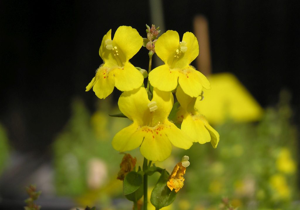
Rocky Mountain monkeyflower (Mimulus gemmiparus) by Jill Handwerk

Rare Plant Inventory, Mapping and Monitoring

CNHP conducts extensive surveys to inventory and monitor rare plant populations across Colorado. We have mapped thousands of locations of over 600 plant taxa of concern and have on-going monitoring for many of our rare plant species.

Visit the Rare Plant Inventory, Mapping and Monitoring Page

Learn more

BBoreal toad (Anaxyrus boreas pop. 1)
Boreal toad (Anaxyrus boreas pop. 1)

Single-species Monitoring for Sensitive Wildlife

CNHP has been a leader in population and ecological studies of rare and lesser-known animal species. We have been leaders in population monitoring of some of Colorado’s rarest animal species, including the boreal toad, the Preble’s meadow jumping mouse, Pawnee montane skipper, and little brown bat.

Visit the Single-species Monitoring for Sensitive Wildlife Page
Learn more

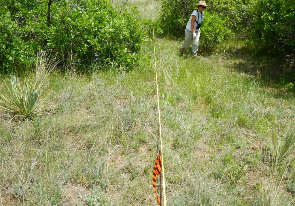
Long-term monitoring plot for leafy spurge (Euphorbia esula).

Noxious Weed Inventory, Mapping and Monitoring

Many of Colorado’s native landscapes have been altered by the arrival of plants from other regions of the globe. Maps of invasive plants and long-term monitoring are critical for effective management and protection of native communities. CNHP conducts surveys to inventory, map and monitor noxious weeds across Colorado.

Visit the Noxious Weed Inventory, Mapping and Monitoring Page

Learn more

Smitherman Conservation Easement in Larimer County, Colorado.

Conservation Easement Monitoring and Baseline Reporting

CNHP scientists perform easement monitoring on a number of ranches in Colorado. We are also engaged with multiple partners to create collaborative solutions for the private lands conservation community. Watch this space for news about conservation easement baseline reporting projects to come!

Visit the Conservation Easement Monitoring and Baseline Reporting Page
Learn more

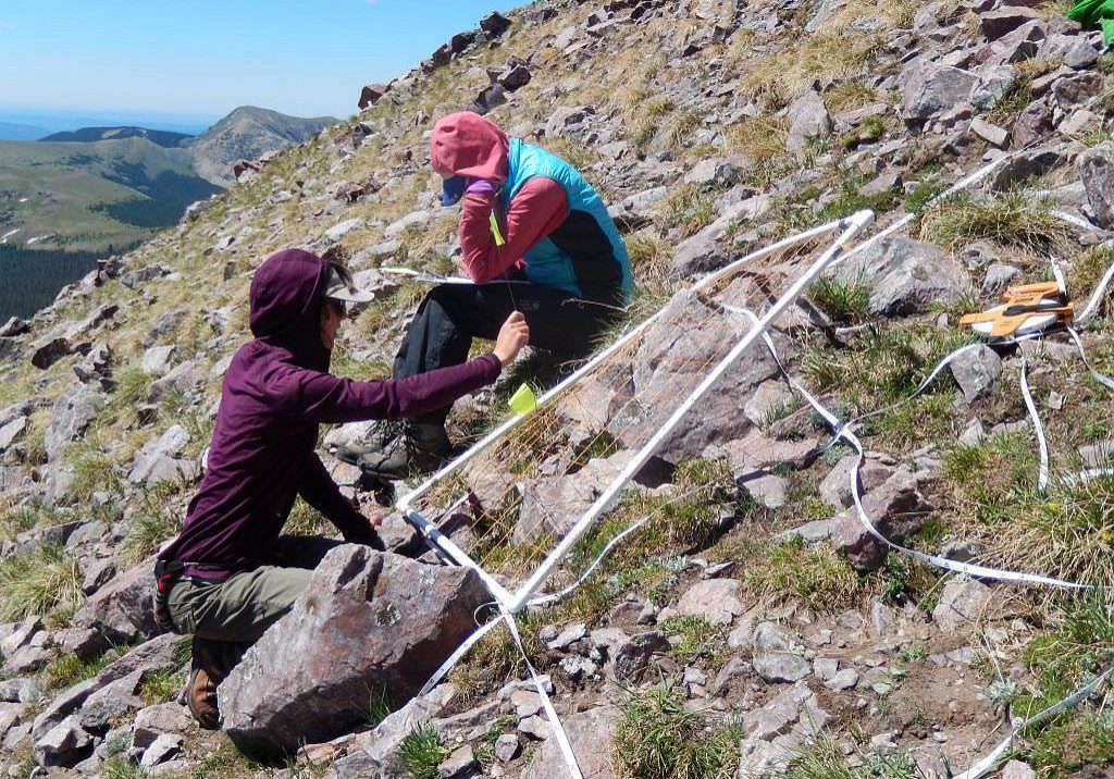
GLORIA plot
GLORIA plot

Global Observation Research Initiative in Alpine Environments (GLORIA)

GLORIA is a long-term, global observation network for the comparative study of climate change impacts on mountain biodiversity, specifically plants. CNHP has been involved in establishing and monitoring GLORIA stations in several National Parks.

Visit the Global Observation Research Initiative in Alpine Environments (GLORIA) Page

Learn more

Gunnison restoration work

Gunnison Basin Climate Change Adaptation and Wetland Restoration Monitoring

Downcutting of streams, often caused by historic grazing, has lowered the water table in many seasonal wetlands in the Gunnison Basin. As part of ongoing work to address climate change in the basin, a collaborative multi-agency team is restoring seasonal wetlands through small-scale modifications to drainage. Results show that such efforts can enhance the resilience of the wetlands under changing climate conditions.

Visit the Gunnison Basin Climate Change Adaptation and Wetland Restoration Monitoring Page

Learn more

CNHP wetland ecologists Erick Carlson and Laurie Gilligan

Wetland Condition Assessment

CNHP has developed several methods to assess and monitor the ecological condition, habitat quality and water quality of wetlands throughout the state. These methods have been applied to assess the condition of wetlands in several large scale wetland assessment projects.

Visit the Wetland Condition Assessment Page

Learn more

CNHP technicians work with National Park Service staff to monitor wetlands in Great Sand Dunes National Park. Photo by Phyllis Pineda Bovin.

Wetland and Riparian Monitoring

CNHP partners with land management agencies to monitor the condition of wetland and riparian ecosystems in Colorado and across the West.

Visit the Wetland and Riparian Monitoring Page

Learn more

Our Services

Database Development
GIS Analysis & Modeling
Mapping
Surveys & Inventories
Monitoring & Assessment Conservation Planning
Private Lands Conservation

Related Topics

Ecology
Wetlands
Plants
Animals
Climate Change
Education
Invasive Species

Web Projects

  • CODEX - Colorado’s Conservation Data Explorer
  • Rare Plant Guide Online
  • Colorado Wetland Info Center
  • COMaP - Colorado Protected Lands
  • Colorado Bat Working Group
  • STReaMS - Endangered Fishes Database
  • Colorado Native Plant Database Data Portal

About Us

  • About Us
  • Conserving Biodiversity
  • Contact Us
  • Staff Directory
  • Careers
  • The NatureServe Network
  • Partners
  • Site Map
Warner College of Natural Resources Logo
  • Apply to CSU
  • Equal Opportunity
  • Disclaimer
  • Privacy Statement
  • Search CSU
  • CSU Land Acknowledgement
  • CSU Principles of Community
© 2025 Colorado Natural Heritage Program
Colorado State University Logo
  • About Us
    ▼
    • About Us
      ▼
      • Biennial Report
      • Strategic Plan
    • Conserving Biodiversity
    • Contact Us
    • Staff Directory
    • Careers
      ▼
      • Employment
      • Internship
      • Volunteer
    • Meetings
    • The NatureServe Network
    • Partners
  • Our Work
    ▼
    • Ecology
    • Wetlands
    • Plants
    • Animals
    • Climate Change
    • Education
    • Invasive Species
    • Statewide Natural Heritage Survey
  • Our Services
    ▼
    • Database Development
    • GIS Analysis & Modeling
    • Mapping
    • Surveys & Inventories
    • Monitoring & Assessment
    • Conservation Planning
    • Private Lands Conservation
  • Our Data
    ▼
    • About CNHP Data
    • Request Data
    • Contribute Data
    • Download Data
    • Tracking Lists
    • Potential Conservation Areas
    • Help & Documentation
  • Maps
    ▼
    • (CODEX) Conservation Data Explorer
    • CNHP Spatial Layers
    • Wetlands Mapper
    • COMaP
  • Library
    ▼
    • Reports
    • Tracking Lists
    • Potential Conservation Areas
    • Field Guides
      ▼
      • Rare Plant Guide
      • Colorado Wetland Field Guides
  • Blog
  • Use CODEX Conservation Data Explorer

  • Donate Now
  • About Us
    ▼
    • About Us
      ▼
      • Biennial Report
      • Strategic Plan
    • Conserving Biodiversity
    • Contact Us
    • Staff Directory
    • Careers
      ▼
      • Employment
      • Internship
      • Volunteer
    • Meetings
    • The NatureServe Network
    • Partners
  • Our Work
    ▼
    • Ecology
    • Wetlands
    • Plants
    • Animals
    • Climate Change
    • Education
    • Invasive Species
    • Statewide Natural Heritage Survey
  • Our Services
    ▲
    • Database Development
    • GIS Analysis & Modeling
    • Mapping
    • Surveys & Inventories
    • Monitoring & Assessment
    • Conservation Planning
    • Private Lands Conservation
  • Our Data
    ▼
    • About CNHP Data
    • Request Data
    • Contribute Data
    • Download Data
    • Tracking Lists
    • Potential Conservation Areas
    • Help & Documentation
  • Maps
    ▼
    • (CODEX) Conservation Data Explorer
    • CNHP Spatial Layers
    • Wetlands Mapper
    • COMaP
  • Library
    ▼
    • Reports
    • Tracking Lists
    • Potential Conservation Areas
    • Field Guides
      ▼
      • Rare Plant Guide
      • Colorado Wetland Field Guides
  • Blog
  • Use CODEX Conservation Data Explorer

  • Donate Now
  • About Us
    ▼
    • About Us
      ▼
      • Biennial Report
      • Strategic Plan
    • Conserving Biodiversity
    • Contact Us
    • Staff Directory
    • Careers
      ▼
      • Employment
      • Internship
      • Volunteer
    • Meetings
    • The NatureServe Network
    • Partners
  • Our Work
    ▼
    • Ecology
    • Wetlands
    • Plants
    • Animals
    • Climate Change
    • Education
    • Invasive Species
    • Statewide Natural Heritage Survey
  • Our Services
    ▼
    • Database Development
    • GIS Analysis & Modeling
    • Mapping
    • Surveys & Inventories
    • Monitoring & Assessment
    • Conservation Planning
    • Private Lands Conservation
  • Our Data
    ▼
    • About CNHP Data
    • Request Data
    • Contribute Data
    • Download Data
    • Tracking Lists
    • Potential Conservation Areas
    • Help & Documentation
  • Maps
    ▼
    • (CODEX) Conservation Data Explorer
    • CNHP Spatial Layers
    • Wetlands Mapper
    • COMaP
  • Library
    ▼
    • Reports
    • Tracking Lists
    • Potential Conservation Areas
    • Field Guides
      ▼
      • Rare Plant Guide
      • Colorado Wetland Field Guides
  • Blog
  • Use CODEX Conservation Data Explorer

  • Donate Now