Colorado Natural Heritage Program Logo Colorado Natural Heritage Program Logo CNHP
  • About Us
    • About Us
      • Biennial Report
      • Strategic Plan
    • Conserving Biodiversity
    • Contact Us
    • Staff Directory
    • Careers
      • Employment
      • Internship
      • Volunteer
    • Meetings
    • The NatureServe Network
    • Partners
  • Our Work
    • Ecology
    • Wetlands
    • Plants
    • Animals
    • Climate Change
    • Education
    • Invasive Species
    • Statewide Natural Heritage Survey
  • Our Services
    • Database Development
    • GIS Analysis & Modeling
    • Mapping
    • Surveys & Inventories
    • Monitoring & Assessment
    • Conservation Planning
    • Private Lands Conservation
  • Our Data
    • About CNHP Data
    • Request Data
    • Contribute Data
    • Download Data
    • Tracking Lists
    • Potential Conservation Areas
    • Help & Documentation
  • Maps
    • (CODEX) Conservation Data Explorer
    • CNHP Spatial Layers
    • Wetlands Mapper
    • COMaP
  • Library
    • Reports
    • Tracking Lists
    • Potential Conservation Areas
    • Field Guides
      • Rare Plant Guide
      • Colorado Wetland Field Guides
  • Blog
  • Use CODEX Conservation Data Explorer

  • Donate Now

Wetland and Riparian Monitoring

CNHP supports both the National Park Service and Bureau of Land Management in long-term wetland and riparian monitoring programs.

National Park Service

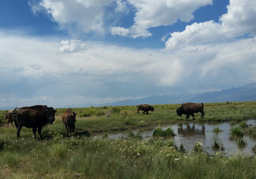
CNHP is partnering with the Rocky Mountain Inventory and Monitoring Program to conduct five years of wetland monitoring in Great Sand Dunes National Park to support the development of an ungulate management plan for the Park. Great Sand Dunes is home to a sizable population of native elk as well as a managed, free-ranging bison herd. Both species preferentially graze in the Park’s extensive wetland complexes at the base of the dunes. In order to understand the impact of ungulate grazing on these wetlands, CNHP and NPS are collecting data on vegetation composition, species diversity, soil condition, groundwater levels, and ungulate use.

Wetlands in Great Sand Dunes National Park.
CNHP technicians set up a monitoring plot in Great Sand Dunes. Photo by Phyllis Pineda Bovin.
Bison graze in a Great Sand Dunes wetland.

Bureau of Land Management

CNHP is collaborating with BLM and U.S. Forest Service scientists to develop a wetland monitoring protocol that can be used through the BLM’s Assessment, Inventory and Monitoring (AIM) Program and for other multi-agency needs. The protocol includes methods for vegetation sampling, soil profile characterization, water quality sampling, and evaluation of land use stressors. CNHP tested preliminary methods during the summer of 2017 and a full draft of the protocol is expected to be released in spring 2018.

CNHP is also assisting the BLM in Utah with stream monitoring through the AIM program. CNHP technicians will conduct up to five years of stream monitoring in Utah in partnership with BLM Fisheries Biologists. For more information about the BLM’s AIM program, visit the Landscape Toolbox website.
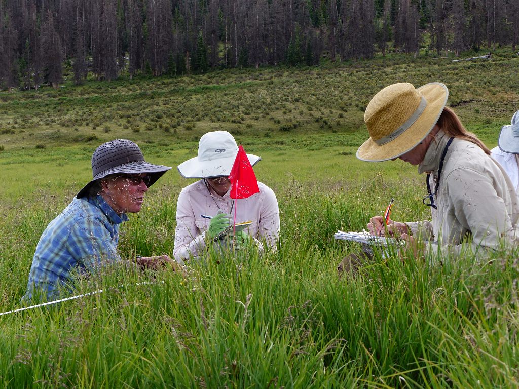
CNHP and BLM Ecologists test preliminary wetland monitoring methods.
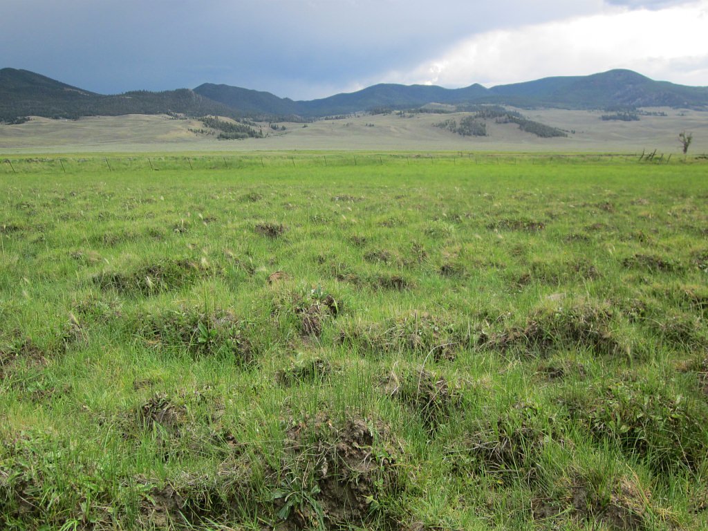
Hummocks can form in wetlands with heavy soil disturbance.
For information, contact Joanna Lemly.

Our Work

Ecology
Wetlands
Plants
Animals
Climate Change
Education
Invasive Species

Related Topics

Database Development
GIS Analysis & Modeling
Mapping
Surveys & Inventories
Monitoring & Assessment
Conservation Planning

Web Projects

  • CODEX - Colorado’s Conservation Data Explorer
  • Rare Plant Guide Online
  • Colorado Wetland Info Center
  • COMaP - Colorado Protected Lands
  • Colorado Bat Working Group
  • STReaMS - Endangered Fishes Database
  • Colorado Native Plant Database Data Portal

About Us

  • About Us
  • Conserving Biodiversity
  • Contact Us
  • Staff Directory
  • Careers
  • The NatureServe Network
  • Partners
  • Site Map
Warner College of Natural Resources Logo
  • Apply to CSU
  • Equal Opportunity
  • Disclaimer
  • Privacy Statement
  • Search CSU
  • CSU Land Acknowledgement
  • CSU Principles of Community
© 2025 Colorado Natural Heritage Program
Colorado State University Logo
  • About Us
    ▼
    • About Us
      ▼
      • Biennial Report
      • Strategic Plan
    • Conserving Biodiversity
    • Contact Us
    • Staff Directory
    • Careers
      ▼
      • Employment
      • Internship
      • Volunteer
    • Meetings
    • The NatureServe Network
    • Partners
  • Our Work
    ▼
    • Ecology
    • Wetlands
    • Plants
    • Animals
    • Climate Change
    • Education
    • Invasive Species
    • Statewide Natural Heritage Survey
  • Our Services
    ▼
    • Database Development
    • GIS Analysis & Modeling
    • Mapping
    • Surveys & Inventories
    • Monitoring & Assessment
    • Conservation Planning
    • Private Lands Conservation
  • Our Data
    ▼
    • About CNHP Data
    • Request Data
    • Contribute Data
    • Download Data
    • Tracking Lists
    • Potential Conservation Areas
    • Help & Documentation
  • Maps
    ▼
    • (CODEX) Conservation Data Explorer
    • CNHP Spatial Layers
    • Wetlands Mapper
    • COMaP
  • Library
    ▼
    • Reports
    • Tracking Lists
    • Potential Conservation Areas
    • Field Guides
      ▼
      • Rare Plant Guide
      • Colorado Wetland Field Guides
  • Blog
  • Use CODEX Conservation Data Explorer

  • Donate Now