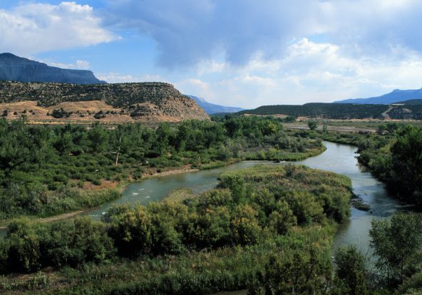
Wetlands and streams are the organs and circulatory system of Colorado’s watersheds—storing, transforming, and transporting water, sediment, nutrients, and organisms from the Rocky Mountain alpine to the plains. Since Colorado became a state in the late 1800s, we have lost approximately 50% of our state’s original wetland area through drainage, fill, or excavation. With each acre of wetland loss, we have lost associated wildlife habitat, water quality, and water storage functions.
Through the process of ecological restoration, or “assisting the recovery of an ecosystem that has been degraded, damaged, or destroyed” (Society for Ecological Restoration), many land owners and managers are attempting to bring back the ecological functions that wetlands once provided across our state. Whether you are a rancher, a consultant, or a federal land manager, you can help conserve and restore Colorado wetlands and streams!
Both voluntary and compensatory (e.g., mitigating for impacts to existing wetlands) restoration projects often follow a process beginning with objectives and site selection, and ending with monitoring and adaptive management. We've outlined this process, along with links to supporting documents and web pages for more information.

Site selection is one of the most important factors in the long-term success of a restoration project, and should be driven by clear restoration goals and objectives. Goals are the big-picture outcomes you hope to achieve by doing restoration work, like improving water quality in a wetland or stream, or reconnecting a channelized stream with its floodplain. Objectives are measurable actions or steps to achieve these goals, like meeting established water quality criteria, or restoring a minimum amount of native wetland plant cover. Examples of key site selection questions, including goals and objectives, are listed below.
- What are the goals and objectives for your project?
- What type of restoration are you hoping to accomplish?
- Is restoration feasible (in terms of cost, land ownership, timing, water rights, etc.) at the site/project area you are evaluating?
- To what extent can you achieve your goals and objectives (e.g., increasing one or more ecological functions) at the site/project area?
- Are site conditions favorable for long-term project success, ideally with minimal human intervention, once the project has been completed?
Wondering where to find restoration sites? Many organizations have identified high-priority sites, and larger potential restoration and conservation areas across Colorado. Please see the Watershed Planning Toolbox online mapping tool for prioritized restoration areas in the Upper Arkansas, South Platte headwaters, and other locations across the state, along with other information to help with site selection. The Colorado Beaver Activity Mapper displays statewide beaver pond clusters from 2013-2021, historical NWI beaver areas and potential beaver dam-building capacity by stream reach for beaver-based or beaver-mimicking riparian restoration projects.
Once you have selected one or more potential sites, it’s time to take a closer look. A few key questions to start with are:
- Was the site historically wetland?
- Can the site support wetland hydrology, given adjacent groundwater and surface water uses?
- Will mitigating a key stressor, such as plugging a drainage ditch system or helping beavers return to the system, allow the site to recover with minimal human intervention?
- Is the site surrounded by, or adjacent to an existing natural wetland complex, or riparian area?
- Is the site likely to support characteristic native plant communities and ecological processes, with minimal human intervention, once wetland soil and hydrology are (re) established?
Click a link below for details.
Over 50% of Colorado's historical wetlands have been lost or altered by drainage, flooding from water storage reservoirs, peat mining, gravel and mineral mining, historical (and recent) beaver trapping, and urban development. Finding wetlands that have been converted to uplands requires evaluation of soils, hydrology, geology, and ecological processes associated with wetland formation. Likely historical wetland mapping for select parts of the state can be found in the Watershed Planning Toolbox online mapper.
Restoring Historical Wetlands
- Some degraded historical wetlands are relatively simple to restore, such as floodplains where beaver can be reintroduced, while others have significant economic, technical, policy, and/or land ownership barriers for restoration (like sites with extensive historical mining and associated tailings piles and water quality concerns). Often, restoration planners and practitioners must weigh the potential increase, or lift, in ecological functions from a proposed restoration project against the cost and technical feasibility of restoration activities.
Hydrology and soils are two of the most important factors in (re)establishing and maintaining a wetland ecosystem. In Colorado, many local and regional flow hydrologic systems have been modified by dams, surface and groundwater diversions (including transbasin diversions pumping water across the Continental Divide and other mountain ranges), stream channelization and incision, drainage ditches, irrigation and associated return flows, and urban runoff. Key hydrologic questions that guide site selection, restoration design, and plant community selection include:
- Is there sufficient water available from natural sources (e.g., groundwater, overbank flooding from an adjacent stream or river) to support your proposed project?
- Do you have water rights to protect natural sources of water?
- Is your site influenced by irrigation; groundwater depletion; altered timing, duration, frequency, and magnitude of peak or low stream flows (due to dams and diversions); or other upslope or upstream flow alteration?
- How might your site be impacted by future hydrologic changes (e.g., reduced late summer stream flow or earlier snowmelt) associated with the different climate change scenarios for Colorado?
Soil is a key component of a successful wetland restoration project, and the foundation for plant growth, nutrient cycling, and other fundamental wetland processes. Current and relic hydric, or poorly drained, soils can help us find areas that were once wetlands prior to being drained or disconnected from natural water sources. Soil alteration through past tilling, mining, or other human disturbance can influence the ability of a site to support native wetland plant communities. The Web Soil Survey allows you to view a map of the soils in your area, including hydric soils. You can also view and download SSURGO soil data by subbasin, and the latest state Hydric Soils Rating by Map Unit here. Once you know which soils are present in your area, the NRCS Official Soil Series Descriptions allow you to search by soil series for detailed soil information.
For soil evaluation in the field, you can view the latest versions of Field Indicators of Hydric Soils and the Field Book for Describing and Sampling Soils here. The Regional Supplements to the Corps of Engineers Delineation Manual also provide a wealth of regional wetland soil information.
Ecological systems and reference sites can provide templates for the types of wetland ecosystems found in your area. If you can access a nearby least-altered wetland or stream reach, you can document which species are present, and how abundant they are throughout the area, along with ecological processes (e.g., natural disturbance, groundwater discharge, predator-prey relationships) and other features that drive the structure and function(s) of the ecosystem. The Wetland and Riparian Plots Database also allows users to search field-collected data, including plant lists by wetland type and watershed, from nearly 3,000 wetland and riparian plots that CNHP has visited since the 1990s.
What is a Reference Site?
- Reference, or least-altered, sites provide examples of ecological processes and groups of plants and other organisms that may have once existed on a nearby degraded site. While reference sites are helpful, it is important to keep in mind that factors like soil and hydrology may be different within your project area, and wetland-forming processes such as flooding may have changed in recent years or decades. Planning for current and future site conditions may be equally or more important than trying to replicate a nearby least-altered system.


Floods, fires, beavers, avalanches and other geomorphic and biotic disturbances are an integral part of the landscape, and have helped form and maintain many of Colorado’s wetlands. In riverine systems, floods and beaver activity help create a mosaic of different habitat types. Fires can either help or harm wetland ecosystems, depending on the degree to which humans have altered the natural fire regime. Some types of wetlands, such as beaver complexes, are resilient in terms of buffering and mitigating for the impacts of large fires, droughts, and floods. Avalanches may influence the vegetation of some slope wetlands.


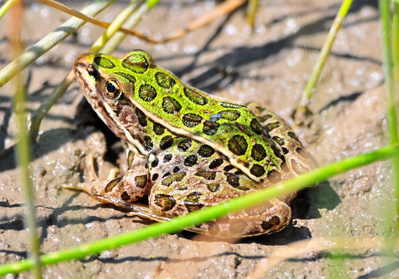
Colorado Parks & Wildlife has identified priority species for conservation in Colorado’s State Wildlife Action Plan. If you have suitable habitat nearby, you may be able to encourage priority bird, fish, mammal, amphibian, or reptile species to use your site. The Intermountain West Joint Venture, covering the western half of the state, and Playa Lakes Joint Venture, focused on playas and prairies in the Great Plains, have a variety of resources for land owners and managers interested in restoring habitats for species like Gunnison Sage-Grouse, Mountain Plover, and Greater Sandhill Crane.


The best restoration plans emphasize simplicity, natural processes, long-term project sustainability (including minimal human intervention), and adaptive management. Often, creating a restoration plan involves working with one or more agencies, a local conservation or watershed group, and/or a private consultant to achieve project objectives. We've provided a list of general wetland restoration resources, as well as a growing list of resources by wetland type. Please check back for new, or updated resources!
General Wetland Restoration Guidance and Resources
- The National Association of Wetland Managers Wetland Restoration site provides regularly updated links for the latest science and technical guidance.
- The NRCS Wetland Restoration, Enhancement, Creation & Construction site provides a variety of wetland restoration technical resources.
- The U.S. Environmental Protection Agency Wetlands Protection and Restoration site
- The Environmental Law Institute’s Good Projects Checklist, which contains valuable information to help members of the public evaluate proposed restoration projects. The checklist was developed for the Gulf of Mexico, but provides a good template for other areas.
Guidance and Case Studies for Restoration by Wetland Type
Beaver-influenced systems (current and historical):
Fens and Other Groundwater Dependent Wetlands:
- Special guidance for managing groundwater dependent ecosystems
- Mountain Studies Institute fen restoration efforts
- USFS Grand Mesa Uncompahgre and Gunnison National Forests fen inventory and restoration work
- The IUCN Peatland Programme's American Peatland Gateway
Kettle Ponds and Playas:
Riparian Wetlands:
- The Utah State University Restoration Consortium has developed a Low-tech Process-based Restoration of Riverscapes Design Manual to help restoration practitioners implement restoration techniques that mimic natural riverine processes.
- RiversEdge West (formerly the Tamarisk Coalition) maintains a resource center specific to stream and riparian area restoration for western Colorado.
- The Colorado Emergency Watershed Protection (EWP) Program Colorado Watershed Flood Recovery page includes a mapping tool, project information, and success stories associated with the recovery effort following the 2013 floods in the Front Range. The EWP Program's Revegetation Plans for Stream Restoration Projects guide also has useful information for plan development and revegetation practices.
- The NOAA Fisheries River RAT Tool provides links for stream restoration and floodplain reconnection science and technical guidance.
See Wetland Best Management Practices for practices to protect and work in wetlands before, during, and after restoration work. Important site preparation considerations include protecting site features such as existing wetlands and rare plants, dealing with invasive species, erosion control, and wildlife exclusion.
If you are a landowner doing voluntary restoration, or simply interested in establishing native plants, the Xerces society has an online site preparation guide for establishing native wildflowers, along with a fillable site preparation timeline and checklist.
Whether you are interested in planting native plants on your property, or restoring a large wetland complex, we’ve included resources to help you find out what to plant, where to purchase plants, and how to propagate and care for native plants as they become established.
Click a link below for details.
![IMG_3988[1] Willow and cottonwood seedlings and rooted cuttings at the Colorado State Forest Service nursery, Fort Collins. Sarah Marshall, CNHP.](https://cnhp.colostate.edu/cwic/wp-content/uploads/sites/5/bb-plugin/cache/IMG_39881-panorama-6983c99a5fe47f202e2c3d34750c774b-5ba01f426de16.jpg)
If you are interested in how your site fits into the larger landscape, the Field Key to Wetland and Riparian Ecological Systems of Colorado and the Wetland and Riparian Plots Database are good places to start when looking at nearby least-altered wetland sites, or typical plant community composition and cover values for the wetland type(s) you are trying to restore.
For more detailed information on Colorado’s wetland plant communities, please see the Field Guide to the Wetland and Riparian Plant Associations of Colorado. Once you have identified one or more plant communities that are appropriate for your restoration site, The Field Guide to Colorado’s Wetland Plants: Identification, Ecology and Conservation and the Colorado Plant Database provide detailed information on Colorado’s wetland plant species, from plant ID to how plants are used by wildlife. Regional wetland plant guides are also available for the Great Plains, Southern Rocky Mountains, and Western Valleys and Plateaus. The Colorado Native Plant Society is also an excellent resource for learning about CO native plants, including a variety of checklists, keys, and habitat information on their Colorado Plants and Habitats page.
Drafting a Plant List
- Once you have a list of potential plants to use on a restoration site, you can evaluate which plants meet your restoration goals, and provide a plant list to a nursery or seed vendor to determine plant material availability and whether you want or need to collect seeds and other plant materials on or near your restoration site.
Wetland indicator status can be useful when choosing groups of plants for different moisture zones on your restoration site. Wetland obligate species tend to require standing water or saturation at or near the soil surface throughout the growing season, while facultative wetland species can often tolerate drier conditions. For the latest indicator status by region in Colorado, the National Wetland Plant List database includes wetland indicator status and other characteristics of plants across the U.S. For information on the different wetland indicator categories, please see the NRCS's wetland indicator status page.
More thorough species-specific propagation, management, and establishment guidance can be found via the USDA Fact Sheets & Plant Guides page, the USDA’s Fire Effects Information System, the Native Plant Revegetation Guide for Colorado.
It is illegal to collect plant materials on public and private lands without explicit permission. Many native plants are also difficult to successfully transplant. Fortunately, Colorado has many native plant nurseries and vendors that will help you find a growing variety of native plants that are appropriate for your site. Many vendors will also grow seed or other plant materials collected on or near your site.
The Colorado Native Plant Society has compiled a list of retail and wholesale native plant vendors, and offers online native plant sales in the fall and spring.
The Colorado State Forest Service grows a variety of wetland and upland riparian plants, from trees and shrubs to sedges and forbs, and is one of several nurseries that will propagate clean seed (with chaff and other debris removed from seeds) from a specific site.
Plant selection and inspection
- When selecting plant materials from a vendor, consider time required for establishment, cost, and probability of plant success when determining the size and type of plant materials (seeds, plugs, potted plants, or bare root plants). Plant materials should be carefully inspected, sometimes at the nursery for larger projects, to ensure the health, vigor, and degree of establishment for potted plants and the purity (lack of non-native or noxious weed seed) of seed mixes.


Whether your restoration project involves plugging ditches that drain a wetland or planting willows in a riparian area, implementing a restoration plan is both rewarding and critical to the long-term success of restoration projects. Before you break ground or start planting, a few things to think about are:
Pre-implementation Checklist
- Timing: early spring and fall are generally the best planting windows for much of Colorado. Consult with local restoration practicioners, or the resources we've provided for plants, to know when to plant at your elevation, and part of the state. Freeze-thaw is also a challenge for getting plants established in many parts of the state, and you may need to use mulch or a certain type of plant material to ensure that your plants aren't pushed out of the ground in the spring.
- Permits: do you have a green light to go forward with earthwork, temporary or permanent wetland impacts, and all other restoration activities? Have you consulted with local and regional biologists to ensure that you are not adversely impacting breeding birds or other sensitive wildlife in your area?
- Erosion control: are you ready for the rain/snow/wind/high water? Colorado is known for its weather extremes, and bare/disturbed soil or sediment are prime for erosion by wind and water. Plant materials such as staked wetland sod or deeper-rooted potted plants or stakes may be more resistant to washing away in erosion-prone areas.
- Weeds: are you starting with a clean slate, or planting native wetland plants in an area with steep competition from weeds?
- Wildlife: are you planting species that are on the menu for deer, elk, geese, beaver, and other wildlife? If so, you may want to consider planting enough to share, or wildlife-friendly fencing and protection.


Monitoring and adaptive management are critical to the successful wetland restoration and enhancement projects. Once you've established reasonable, and feasible goals and objectives, as well as a good restoration plan, a monitoring plan can be used to identify indicators of project success and performance standards. These standards can be based on research, regulations, or mapped to project objectives like increasing habitat for a priority species. We've provided some common wetland assessment and monitoring methods for Colorado as examples, as well as some specific monitoring guidance for special situations and photo points.

Common Wetland Monitoring Methods for Colorado
- The Functional Assessment of Colorado Wetlands (FACWet) Method is often used to evaluate wetland ecological functions before and after restoration for compensatory mitigation
- For projects with a plant community focus, or long-term ecological monitoring, CNHP has developed wetland assessment methods, including the Ecological Integrity Assessment method for site-scale assessments.
- The EPA’s National Wetland Condition Assessment (NWCA) methods are some of the more detailed wetland assessment methods currently being applied across the U.S., and include water and soil chemical analyses along with vegetation monitoring. NWCA has many elements in common with CNHP’s EIA methods, including plot layout and vegetation sampling design.
- CNHP has collaborated with the U.S. Bureau of Land Management to develop a wetland and riparian monitoring protocol focused on wetlands in rangeland environments.
- For streams restoration projects, the Colorado Streams Quantification Tool (SQT) method was developed for pre- and post-restoration monitoring.
- For sites impacted by oil spills or other hazardous waste (including mining areas), NatureServe has developed a User Guide for Wetland Assessment and Monitoring in Natural Resource Damage Assessment and Restoration.
Photo documentation is a critical part of monitoring a site before, during, and after restoration and enhancement work. Photos are useful for education and outreach, and documenting restoration progress for permitting and funding agencies. With modern digital cameras and computer storage space, it is easy to have many photos for a site, but just as important to take photos that capture key elements related to restoration objectives. The U.S. Forest Service Photo Point Monitoring Guide provides a summary of key steps in a establishing a successful photo monitoring program.


