The Colorado Wetland Inventory Mapping Tool displays several different datasets depicting the location and classification of wetlands in Colorado. There are currently over 1.7 million acres of wetlands and waterbodies mapped within Colorado, representing less than 3% of the landscape. Use this mapping tool to explore where wetlands are located or see the Landscape Summaries for an accounting of wetland acres by river basin, subbasin, and county.
- Wetland mapping produced by CNHP and others for the National Wetlands Inventory Program.
- Riparian mapping produced by Colorado Parks and WIldlife.
- Potential fen mapping produced by various parties.
- Potential playa mapping produced by the Bird Conservancy of the Rockies and Playa Lakes Joint Venture.


In addition to the wetland datasets, the Colorado Wetland Inventory Mapping Tool includes two data products created by CNHP.
- Potential Conservation Areas (PCAs), which represent wetland and riparian areas with high biodiversity significance.
- Wetland Stressors, a statewide model that integrates stress to aquatic resources from roads, development, resource extraction, and hydrologic modification.
- Launch the Colorado Wetland Inventory Mapping Tool
- Launch the USFWS National Wetland Inventory (NWI) Mapping Tool
- View the NWI Code Diagram
- View the NWI Code Interpreter

History of Wetland Mapping in Colorado
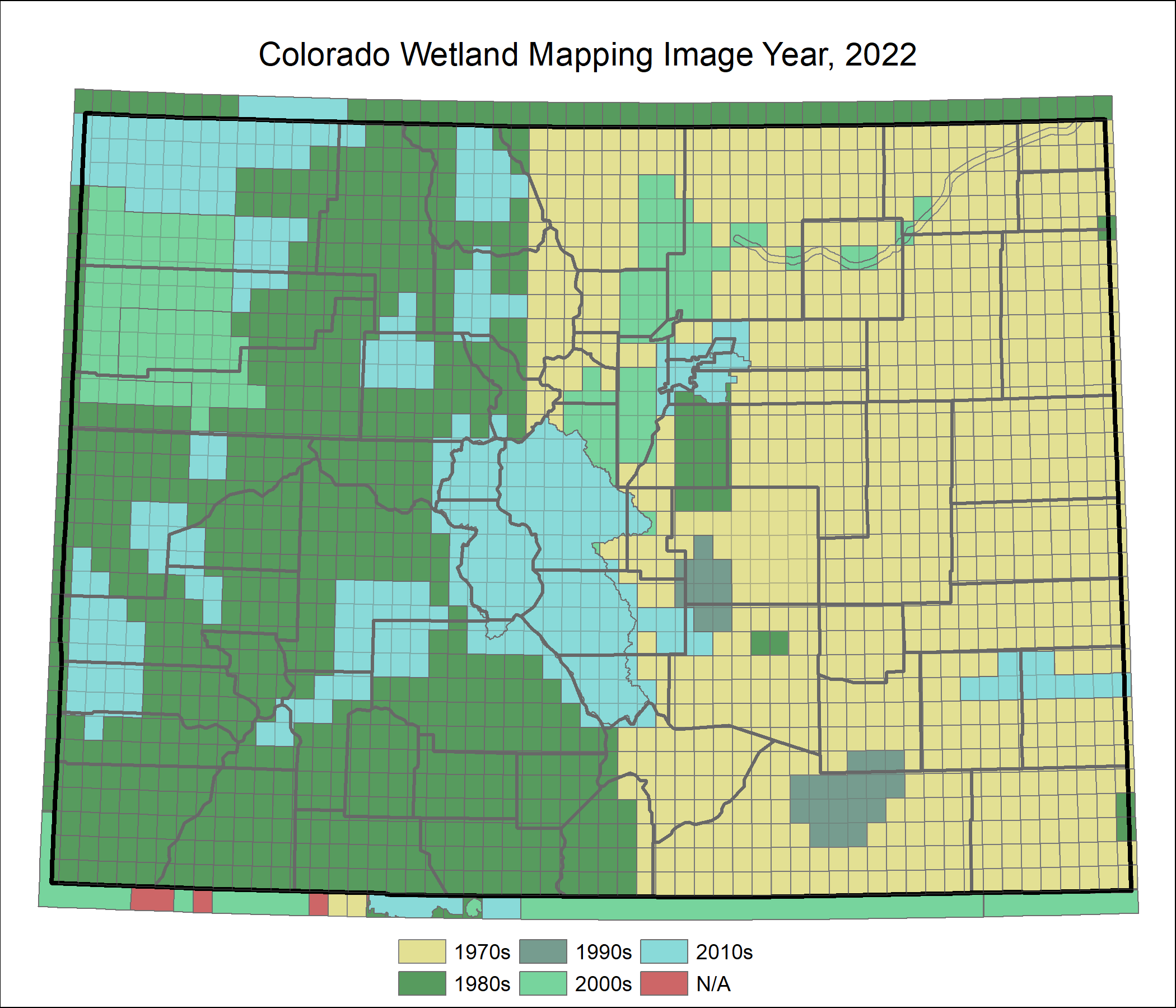
Historically, Colorado lagged behind most of the country in terms of digital wetland data. The USFWS National Wetland Inventory did map all of Colorado in the 1970s and 1980s, in the early years of the program. However, all the early maps were produced as mylar overlays of U.S. Geological Survey topographic maps. The only way to obtain NWI mapping was to purchase the data as a hard-copy paper map, one topographic quadrangle at a time. CNHP started working on wetland mapping in 2007, when less than 15% of the state had digital data available. Since 2007, CNHP focused on converting scanned NWI images into digital data for huge areas of the state, and we have produced updated photo-interpretation of wetland mapping in several areas. As of 2015, we now have statewide digital coverage of NWI mapping for all of Colorado. CNHP has been able to accomplish this by partnering with numerous agencies such as Colorado Parks and Wildlife, the Environmental Protection Agency, the Bureau of Land Management, the U.S. Forest Service, the Transportation Research Board, the Southern Rockies Landscape Conservation Cooperative and several local governments.


