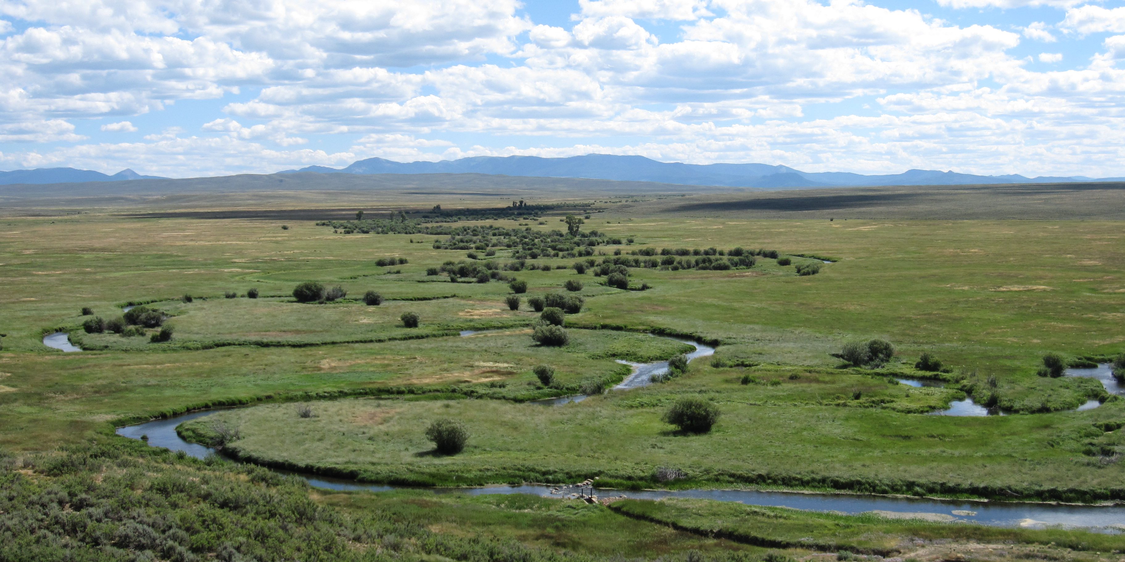
In 2008, CNHP began a series of field projects to assess the condition of wetlands in Colorado’s major river basins. Our goal is to survey each of the major river basins on a rotating schedule every 10 to 15 years. Results from these surveys help guide restoration priorities for Colorado Parks and Wildlife’s Wetland Program and other conservation partners.
Click on the river basin map to view the river basin reports or click a link below for details.

2008-2011
Assessment of Wetland Condition on the Rio Grande National Forest
Joanna Lemly
The initial pilot basin-wide assessment took place between 2008–2011 in the Rio Grande Headwaters River Basin in south central Colorado. The study followed the EPA’s Level 1-2-3 framework of wetland assessment, using various degrees of data collection intensity to estimate the extent and condition of wetlands. There were 282,804 acres of wetlands and water-bodies mapped by the National Wetland Inventory (NWI) in the basin, representing 6% of the land area, and these acres were unequally distributed across geographic regions and major land owners. A Level 1 Landscape Integrity Model was developed to predict the degree of landscape-level stress on aquatic resources. Wetland in the basin were concentrated within the San Luis Valley, and these acres were more likely to be irrigated or ditched and face more severe stressors. Wetlands in the mountainous areas of the basin were more diverse and less stressed. During the summers of 2008, 2009, and 2010, 162 wetlands were visited and assessed using Level 2 & 3 field-based protocols. Field results concurred with patterns seen in the Level 1 GIS exercise. Marshes and saline wetlands, found more commonly at lower elevations, had lower condition scores in general. Fens and riparian shrub-lands, found more commonly at higher elevations, had higher condition scores. Wet meadows were the most common wetland type surveyed and spanned both the geographic range of the study area and the condition gradient.

- To view the full report, click here.
- To view a supplemental report on wetlands on the Rio Grande National Forest, click here.
2009-2011
North Platte River Basin Wetland Profile and Condition Assessment
Joanna Lemly and Laurie Gilligan
The second basinwide assessment took place between 2009–2011 in the North Platte River Basin in north central Colorado. Similar to the Rio Grande Headwater project, various degrees of data collection intensity were used to estimate wetland condition. There were 138,043 acres of wetlands and waterbodies mapping by the National Wetland Inventory (NWI) in the basin, representing 10% of the land area. Wetlands in the basin were dis-proportionally concentrated in the North Park valley, where flood irrigation for hay production creates vast expanses of wet meadow. Within the basin, 75% of herbaceous wetlands were also mapped as irrigated lands. Some of these acres are natural wetlands along the basin’s many floodplains, while others are likely created by more than a century. For field-based assessments, wetlands actively managed as hay pastures were removed from the field sampling to concentrate on the more naturalized wetlands of the basin. Population level estimates of wetland condition indicate that 82% (44,409 acres) of non-irrigated wetlands were in excellent or good condition based on the Ecological Integrity Assessment scores, meaning they were in reference condition or deviated only slightly from reference condition. An additional 17% (9,096 acres) were rated fair, meaning a moderate deviation from reference condition that would warrant some type of management or restoration. Few wetlands had signs of severe hydrologic alteration that would significantly threaten wetland health. There was little substrate disturbance and no obvious visual signs of water quality impairment. Biotic condition was generally high. Very few noxious weeds were observed, though wetlands that were former hay fields or adjacent to active hay field contained significant cover on non-native species. The North Platte River Basin report also included an evaluation of the potential habitat quality for dabbling ducks, carried out separately by Colorado Park and Wildlife.

- To view the full report, click here.
2012-2014
Lower South Platte River Basin Wetland Profile and Condition Assessment
Joanna Lemly, Laurie Gilligan, and Gabrielle Smith
The Lower South Platte River Basin was the third basinwide assessment project. This basin contains among the most important migratory bird habitat in the state and is a priority area for the Colorado Parks and Wildlife (CPW) and many partner organizations. This Lower South Platte project had four main objectives: (1) to create a digital map of wetlands in the Lower South Platte River Basin; (2) to research habitat requirements of target wildlife species; (3) to identify reference condition wetlands in the basin; and (4) to conduct a statistically valid, field-based survey of wetland condition in the basin. Converting original National Wetlands Inventory (NWI) maps from the 1970s into digital data allowed for the first estimate of wetland acres across the basin: 158,468 acres of wetlands and 95,193 acres of lakes and rivers were mapped by NWI in the 1970s. More than half these acres were concentrated along the South Platte floodplain, with an additional 15% spread across the Front Range. The mapping showed a clear dominance of herbaceous wetlands across the basin, though forested wetlands made up a notable 27% of mapped acres. Mapped wetlands and aquatic resources in the basin were overwhelmingly (83%) located on private lands. A systematic accuracy assessment of the wetland mapping, however, indicated that the raw NWI data was unreliable for estimating the extent and distribution of wetlands within today’s landscape. The greatest sources of inaccuracy in this study area were overmapped forested wetlands, many of which would be mapped as non-wetland riparian areas today, and overmapped herbaceous wetlands, many of which are now too dry to be considered wetlands.
Important conclusions can be drawn from the assessment of wetland condition as well. The Level 1 landscape analysis indicated that the majority of mapped wetlands experience high or severe stress (80% between the two stress classes). Field data also indicated high stress on wetlands and riparian areas in the basin. Ecological Integrity Assessment scores for random sites showed that nearly a third of randomly selected sites were rated in good condition, just over half (57%) were rated in fair condition, and an additional 12% were rated in poor condition, indicating significant deviation from reference. Among the component scores, sites rated highest for landscape context and lowest for biotic integrity. The generally rural landscape of the Lower South Platte River basin contained less modification than other, more developed regions of the state. However, the vegetation in South Platte wetlands and riparian areas is highly disturbed and contains considerable cover of non-native species.

- To view the full report, click here.
2013-2016
Lower Arkansas River Basin Wetland Mapping and Reference Network
Joanna Lemly, Laurie Gilligan, Gabrielle Smith, and Catherine Wiechmann
The Lower Arkansas Basin wetland assessment project was the fourth basinwide assessment and was divided into two phases. The objectives of Phase 1 were to 1) create a digital map of wetlands in the Lower Arkansas Basin; 2) identify and assess a network of reference standard wetlands and riparian areas; and 3) research habitat requirements of target wetland-dependent wildlife species within the basin. The objectives of Phase 2 were to 1) produce overall basin-wide estimates of ecological condition for wetlands and riparian areas in the basin by sampling a spatially balanced, randomly selected set of sites and 2) pilot the collection of water quality data in wetlands. Original National Wetland Inventory (NWI) mapping of the Lower Arkansas basin contained 205,587 acres of aquatic resources, including both wetlands and waterbodies, representing only 1.5% of the total land area. However, overall accuracy of the original map was only 47.6% (90% CI = 44.8?50.5%). The most significant source of discrepancy was within the forested wetland class. While the original mapping contained >30,000 acres of forested wetlands, the revised estimate showed less than 1,300 acres, indicating 96% fewer acres of forested wetlands than the original mapping showed. To improve the NWI mapping, this project included funding to update the mapping within 18 USGS quads, twelve quads around John Martin Reservoir and six quads around and upstream of Pueblo Reservoir.
To assess the condition of wetlands in the basin, 48 high quality, reference condition wetlands and riparian areas were hand selected across the basin to represent the most common wetland and riparian type. These reference sites helped establish threshold for condition in the basin. Nearly thirty percent of the reference sites were rated excellent for overall ecological integrity and an additional 52% were rated in good condition. To assess condition across the basin, 62 random wetland and riparian sites were selected based on a spatially balanced probabilistic sample design. Basinwide estimates produced from the random assessment indicate that 35% of wetland and riparian acres across the basin are in good condition, 60% in fair condition, and 5% in poor condition. No randomly selected sites were found in excellent condition.

For the pilot water quality study, water samples were collected in 29 sites within three common wetland types in the basin (marshes, plains riparian areas, and playas). The most notable result from the water quality study was the contrast between values measured in marshes and plains riparian areas, which were generally similar to the Arkansas River mainstem, and playas, which were strikingly different. In addition, there were clear patterns related to location within the basin and by proximity to intensive land uses. Marshes sampled in the basin, particularly those on the floodplain and influenced by irrigation return flows, had high EC, high hardness, and high concentrations of dissolved cations and sulfates. Water quality values in plains riparian areas were variable depending on location within the basin, surrounding geology, and proximity to the Arkansas floodplain. In contrast, playas had lower EC, alkalinity, hardens, dissolved cations, and sulfate than other wetland types.

- To view the full Phase 1 report, click here.
- To view the full Phase 2 report, click here.


