Colorado Natural Heritage Program Logo Colorado Natural Heritage Program Logo CNHP
  • About Us
    • About Us
      • Biennial Report
      • Strategic Plan
    • Conserving Biodiversity
    • Contact Us
    • Staff Directory
    • Careers
      • Employment
      • Internship
      • Volunteer
    • Meetings
    • The NatureServe Network
    • Partners
  • Our Work
    • Ecology
    • Wetlands
    • Plants
    • Animals
    • Climate Change
    • Education
    • Invasive Species
  • Our Services
    • Database Development
    • GIS Analysis & Modeling
    • Mapping
    • Surveys & Inventories
    • Monitoring & Assessment
    • Conservation Planning
  • Our Data
    • About CNHP Data
    • Request Data
    • Contribute Data
    • Download Data
    • Tracking Lists
    • PCA Reports
    • Help & Documentation
  • Maps
    • CNHP Spatial Layers
    • Wetlands Mapper
    • COMaP
    • Conservation Environmental Review Tool
  • Library
    • Reports
    • PCA Reports
    • Tracking Lists
    • Field Guides
      • Rare Plant Guide
      • Colorado Wetland Field Guides
  • Blog
  • Donate Now

Viewing Category - Biodiversity Scorecard

CNHP Blog

Ecological Systems: Sagebrush Shrublands

November 29, 2011
There are two major types of sagebrush ecological systems in Colorado: big sagebrush shrublands and montane sagebrush steppe. […]

Filed Under: Biodiversity Scorecard, Conservation Planning, Ecology

Ecological Systems: Mixed Conifer Forest

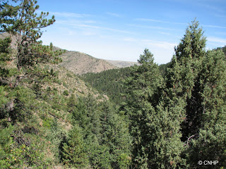
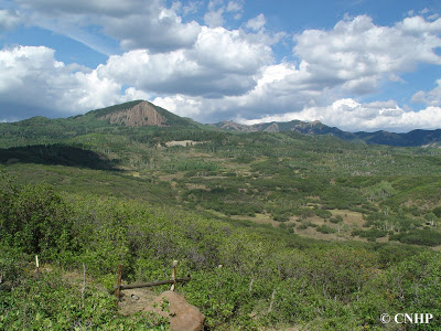
October 25, 2011
800×600 Normal 0 false false false EN-US X-NONE X-NONE MicrosoftInternetExplorer4 These are mixed-conifer forests occurring on all aspects […]

Filed Under: Biodiversity Scorecard, Conservation Planning, Ecology

Ecological systems: Grasslands

August 2, 2011
Grasslands other than those of the Shortgrass Prairie in Colorado can be classified into three major groups: Western […]

Filed Under: Biodiversity Scorecard, Conservation Planning, Ecology

Ecological Systems: Colorado Plateau Pinyon-Juniper

June 9, 2011
In Colorado, pinyon-juniper ecological systems may occur as shrublands or woodlands, or as sparsely vegetated bedrock canyon and […]

Filed Under: Biodiversity Scorecard, Ecology

Ecological Systems: Oak – Mixed Mountain Shrublands

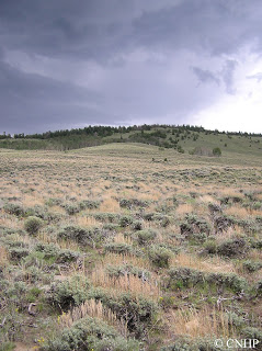
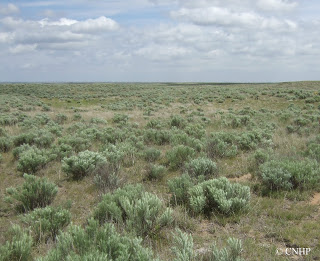
May 18, 2011
Oak shrubland (foreground) in Archuleta County These are montane shrublands generally occurring at elevations from approximately 6,500 to […]

Filed Under: Biodiversity Scorecard, Conservation Planning, Ecology

Ecological Systems: Sandsage Shrubland

April 19, 2011
These shrublands dominate sandy areas on Colorado’s eastern plains, where they often intermingle with shortgrass prairie to form […]

Filed Under: Biodiversity Scorecard, Conservation Planning, Ecology

  • « Previous Page
  • 1
  • 2
  • 3
  • 4
  • Next Page »

About Us

About Us
Conserving Biodiversity
Contact Us
Staff Directory
Careers
Employment
Internship
Volunteer
Meetings
The NatureServe Network
Partners

Our Work

Ecology
Wetlands
Plants
Animals
Climate Change
Education
Invasive Species

Blog Archive

Blog Categories

Web Projects

  • Rare Plant Guide Online
  • Colorado Wetland Info Center
  • COMaP - Colorado Protected Lands
  • Colorado Bat Working Group
  • STReaMS - Endangered Fishes Database

About Us

  • About Us
  • Conserving Biodiversity
  • Contact Us
  • Staff Directory
  • Careers
  • The NatureServe Network
  • Partners
  • Site Map
Warner College of Natural Resources Logo
  • Apply to CSU
  • Equal Opportunity
  • Disclaimer
  • Privacy Statement
  • Search CSU
  • CSU Land Acknowledgement
  • CSU Principles of Community
© 2026 Colorado Natural Heritage Program
Colorado State University Logo
  • About Us
    ▼
    • About Us
      ▼
      • Biennial Report
      • Strategic Plan
    • Conserving Biodiversity
    • Contact Us
    • Staff Directory
    • Careers
      ▼
      • Employment
      • Internship
      • Volunteer
    • Meetings
    • The NatureServe Network
    • Partners
  • Our Work
    ▼
    • Ecology
    • Wetlands
    • Plants
    • Animals
    • Climate Change
    • Education
    • Invasive Species
  • Our Services
    ▼
    • Database Development
    • GIS Analysis & Modeling
    • Mapping
    • Surveys & Inventories
    • Monitoring & Assessment
    • Conservation Planning
  • Our Data
    ▼
    • About CNHP Data
    • Request Data
    • Contribute Data
    • Download Data
    • Tracking Lists
    • PCA Reports
    • Help & Documentation
  • Maps
    ▼
    • CNHP Spatial Layers
    • Wetlands Mapper
    • COMaP
    • Conservation Environmental Review Tool
  • Library
    ▼
    • Reports
    • PCA Reports
    • Tracking Lists
    • Field Guides
      ▼
      • Rare Plant Guide
      • Colorado Wetland Field Guides
  • Blog
  • Donate Now