Colorado Natural Heritage Program Logo Colorado Natural Heritage Program Logo CNHP
  • About Us
    • About Us
      • Biennial Report
      • Strategic Plan
    • Conserving Biodiversity
    • Contact Us
    • Staff Directory
    • Careers
      • Employment
      • Internship
      • Volunteer
    • Meetings
    • The NatureServe Network
    • Partners
  • Our Work
    • Ecology
    • Wetlands
    • Plants
    • Animals
    • Climate Change
    • Education
    • Invasive Species
  • Our Services
    • Database Development
    • GIS Analysis & Modeling
    • Mapping
    • Surveys & Inventories
    • Monitoring & Assessment
    • Conservation Planning
  • Our Data
    • About CNHP Data
    • Request Data
    • Contribute Data
    • Download Data
    • Tracking Lists
    • PCA Reports
    • Help & Documentation
  • Maps
    • CNHP Spatial Layers
    • Wetlands Mapper
    • COMaP
    • Conservation Environmental Review Tool
  • Library
    • Reports
    • PCA Reports
    • Tracking Lists
    • Field Guides
      • Rare Plant Guide
      • Colorado Wetland Field Guides
  • Blog
  • Donate Now

Site profile: Mee Canyon, Mesa County

May 27, 2010

B2: Very High Biodiversity Significance

Mee Canyon, Colorado

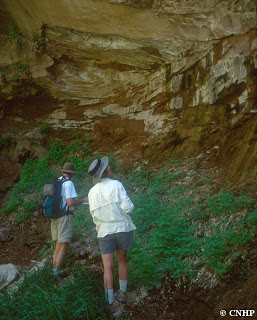
This site was visited in 2002 as part of the Mesa County Wetland Inventory. In western Colorado’s Black Ridge Canyons Wilderness, this scenic redrock canyon contains an enormous cavern cut by a meander of a small stream which drains to the Colorado River. The canyon is rimmed with red Entrada sandstone, and its steep sides are formed in the Kayenta and Wingate formations.

Above the canyon, the mesas supports an excellent example of the Utah juniper/saline wildrye (Juniperus osteosperma/Leymus salinus) community, as well as characteristic stands of black sage (Artemisia novum), Indian ricegrass (Achnatherum hymenoides) and needle and thread grass (Hesperostipa sp.). Dry slopes on the side of the canyon have scattered Utah juniper (Juniperus osteosperma), Fremont barberry (Mahonia fremontii), and cliffrose (Cowania mexicana).

standing in the canyon
Sandstone walls oozing moisture that supports rare species

The canyon bottom is ungrazed, and the difficulty of access to the upper reaches has probably protected it from human impacts. In the narrow riparian area at the bottom of the canyon, the stream banks are covered by dense growth of scouring rushes (Hippochaete sp.), with giant helleborine orchids (Epipactis gigantea) and scattered box elders (Acer negundo) growing among them. Not far from the cavern is a grotto with seeping walls that supports a good example of the globally imperiled hanging garden community (Aquilegia micrantha–Mimulus eastwoodiae), characterized by the yellow Mancos columbine. The state imperiled canyon tree frog (Hyla arenicolor) also occurs here, close to the northern limit of its distribution.

Aquilegia micrantha
The Mancos columbine (Aquilegia micrantha)

Hyla arenicolor
A canyon treefrog (Hyla arenicolor)

SHARE
FACEBOOK
TWITTER
LINKEDIN
REDDIT
EMAIL
Filed Under: County Inventory, Ecology, Potential Conservation Areas, Wetlands

Rare Plant Conservation Initiative CAP meeting: Dolores and San Miguel Counties
Reports from the field: flash flood

About Us

About Us
Conserving Biodiversity
Contact Us
Staff Directory
Careers
Employment
Internship
Volunteer
Meetings
The NatureServe Network
Partners

Our Work

Ecology
Wetlands
Plants
Animals
Climate Change
Education
Invasive Species

Blog Archive

Blog Categories

Web Projects

  • Rare Plant Guide Online
  • Colorado Wetland Info Center
  • COMaP - Colorado Protected Lands
  • Colorado Bat Working Group
  • STReaMS - Endangered Fishes Database

About Us

  • About Us
  • Conserving Biodiversity
  • Contact Us
  • Staff Directory
  • Careers
  • The NatureServe Network
  • Partners
  • Site Map
Warner College of Natural Resources Logo
  • Apply to CSU
  • Equal Opportunity
  • Disclaimer
  • Privacy Statement
  • Search CSU
  • CSU Land Acknowledgement
  • CSU Principles of Community
© 2026 Colorado Natural Heritage Program
Colorado State University Logo
  • About Us
    ▼
    • About Us
      ▼
      • Biennial Report
      • Strategic Plan
    • Conserving Biodiversity
    • Contact Us
    • Staff Directory
    • Careers
      ▼
      • Employment
      • Internship
      • Volunteer
    • Meetings
    • The NatureServe Network
    • Partners
  • Our Work
    ▼
    • Ecology
    • Wetlands
    • Plants
    • Animals
    • Climate Change
    • Education
    • Invasive Species
  • Our Services
    ▼
    • Database Development
    • GIS Analysis & Modeling
    • Mapping
    • Surveys & Inventories
    • Monitoring & Assessment
    • Conservation Planning
  • Our Data
    ▼
    • About CNHP Data
    • Request Data
    • Contribute Data
    • Download Data
    • Tracking Lists
    • PCA Reports
    • Help & Documentation
  • Maps
    ▼
    • CNHP Spatial Layers
    • Wetlands Mapper
    • COMaP
    • Conservation Environmental Review Tool
  • Library
    ▼
    • Reports
    • PCA Reports
    • Tracking Lists
    • Field Guides
      ▼
      • Rare Plant Guide
      • Colorado Wetland Field Guides
  • Blog
  • Donate Now