Colorado Natural Heritage Program Logo Colorado Natural Heritage Program Logo CNHP
  • About Us
    • About Us
      • Biennial Report
      • Strategic Plan
    • Conserving Biodiversity
    • Contact Us
    • Staff Directory
    • Careers
      • Employment
      • Internship
      • Volunteer
    • Meetings
    • The NatureServe Network
    • Partners
  • Our Work
    • Ecology
    • Wetlands
    • Plants
    • Animals
    • Climate Change
    • Education
    • Invasive Species
    • Statewide Natural Heritage Survey
  • Our Services
    • Database Development
    • GIS Analysis & Modeling
    • Mapping
    • Surveys & Inventories
    • Monitoring & Assessment
    • Conservation Planning
    • Private Lands Conservation
  • Our Data
    • About CNHP Data
    • Request Data
    • Contribute Data
    • Download Data
    • Tracking Lists
    • Potential Conservation Areas
    • Help & Documentation
  • Maps
    • (CODEX) Conservation Data Explorer
    • CNHP Spatial Layers
    • Wetlands Mapper
    • COMaP
  • Library
    • Reports
    • Tracking Lists
    • Potential Conservation Areas
    • Field Guides
      • Rare Plant Guide
      • Colorado Wetland Field Guides
  • Blog
  • Use CODEX Conservation Data Explorer

  • Donate Now

Natural Plant Communities of Colorado

The U.S. National Vegetation Classification (USNVC) provides a hierarchical ordering of vegetation in the Unites States from broad scale formations like forests to fine-scale plant communities. The USNVC is organized into an 8-level hierarchy. The upper levels of the hierarchy are based on dominant and diagnostic growth forms that reflect environment at global to continental scales. The mid-levels are based on dominant and diagnostic growth forms and compositional similarity reflecting biogeography and continental to regional environmental factors. The lower levels (alliance and association) are based on diagnostic and/or dominant species and compositional similarity reflecting local to regional environmental factors.

Talking about all things conservation science!
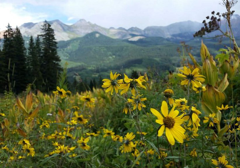
Colorado wildflowers
Fall in the San Juan Mountains by Michael Menefee.

CNHP tracks natural plant communities at the lowest level of the USNVC, the “plant association” level. Approximately 750 individual plant associations have been defined for Colorado, though there is not a complete statewide map of vegetation at this level and research is ongoing to refine this list. Read more about CNHP's natural plant community element occurrences or view our tracking list.

The USNVC is jointly administered by NatureServe, Ecological Society of America, and the U.S. Geological Survey.

For more information on the USNVC, please visit:

  • U.S. National Vegetation Classification
  • NatureServe Explorer

Our Services

Database Development
GIS Analysis & Modeling
Mapping
Surveys & Inventories
Monitoring & Assessment Conservation Planning
Private Lands Conservation

Related Topics

Ecology
Wetlands
Plants
Animals
Climate Change
Education
Invasive Species

Web Projects

  • CODEX - Colorado’s Conservation Data Explorer
  • Rare Plant Guide Online
  • Colorado Wetland Info Center
  • COMaP - Colorado Protected Lands
  • Colorado Bat Working Group
  • STReaMS - Endangered Fishes Database
  • Colorado Native Plant Database Data Portal

About Us

  • About Us
  • Conserving Biodiversity
  • Contact Us
  • Staff Directory
  • Careers
  • The NatureServe Network
  • Partners
  • Site Map
Warner College of Natural Resources Logo
  • Apply to CSU
  • Equal Opportunity
  • Disclaimer
  • Privacy Statement
  • Search CSU
  • CSU Land Acknowledgement
  • CSU Principles of Community
© 2025 Colorado Natural Heritage Program
Colorado State University Logo
  • About Us
    ▼
    • About Us
      ▼
      • Biennial Report
      • Strategic Plan
    • Conserving Biodiversity
    • Contact Us
    • Staff Directory
    • Careers
      ▼
      • Employment
      • Internship
      • Volunteer
    • Meetings
    • The NatureServe Network
    • Partners
  • Our Work
    ▼
    • Ecology
    • Wetlands
    • Plants
    • Animals
    • Climate Change
    • Education
    • Invasive Species
    • Statewide Natural Heritage Survey
  • Our Services
    ▼
    • Database Development
    • GIS Analysis & Modeling
    • Mapping
    • Surveys & Inventories
    • Monitoring & Assessment
    • Conservation Planning
    • Private Lands Conservation
  • Our Data
    ▼
    • About CNHP Data
    • Request Data
    • Contribute Data
    • Download Data
    • Tracking Lists
    • Potential Conservation Areas
    • Help & Documentation
  • Maps
    ▼
    • (CODEX) Conservation Data Explorer
    • CNHP Spatial Layers
    • Wetlands Mapper
    • COMaP
  • Library
    ▼
    • Reports
    • Tracking Lists
    • Potential Conservation Areas
    • Field Guides
      ▼
      • Rare Plant Guide
      • Colorado Wetland Field Guides
  • Blog
  • Use CODEX Conservation Data Explorer

  • Donate Now