

By Erick Carlson, CNHP Wetland Ecologist
The beginning of the field season has been very successful with cooperative weather, limited bug activity and some surprisingly interesting wetlands! The project that gets fellow wetland ecologist Laurie Gilligan and myself out of the office this summer is a basin-wide survey of the wetlands in north-central and northeast Colorado. This year we are tackling the very large South Platte River basin. Because it is so large we are working on just the “lower” portion, east of the mountain front. So our study area extends in a giant triangle from Castle Rock, north to the Wyoming border and then all the way east to where the South Platte River exits the state. As you can imagine this is a HUGE area, with widely varying environments from the lush canyons pouring snowmelt out of the foothills, to dusty dry depressional wetlands (playas) on the plains.
 |
| The South Platte River basin in Colorado. Basemap courtesy of National Geographic and ESRI. |
Laurie has spent and continues to spend too many hours inside finding us sites to survey, gaining permission and generally getting everything lined up so our days in the field are simple, focused and fun. With such a large area and such a diverse range of wetlands this summer we are focused on surveying reference wetlands; so we are working in the “best of the best” in the largely urban Front Range corridor and the largely agricultural Eastern Plains. Honestly, we expected some less than pretty wetlands but have been pleasantly surprised with species lists exceeding 55 per site, limited noxious weeds, and few people. All these characteristics do not occur at every site, but so far the wetlands have been very exciting to work in.
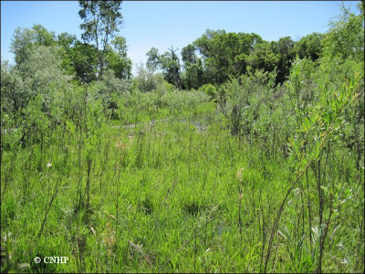 |
| A nice riparian wetland on the Little Thompson River. |
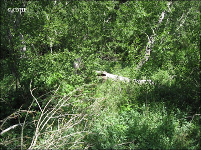 |
| Where to walk? Turns out it didn’t matter, it was all poison ivy anyway. |
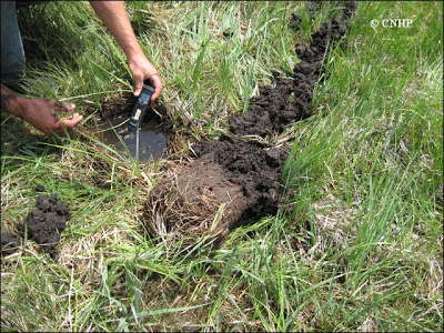
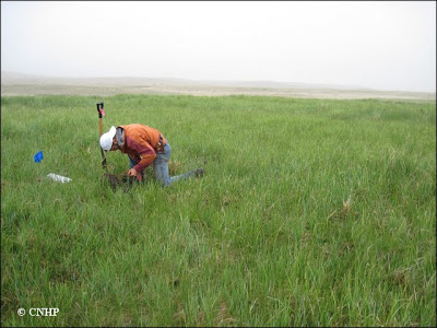 |
| Dropping in the auger to confirm that we are standing on a fen with more than 40 cm of organic matter. |
To date we’ve stuck our botany noses in 12 sites across the study area including sandy washes, foothills canyons, plains playas, and a surprising fen. And yes, playas are supposed to be dry. They are naturally dry for periods of the year, or for multiple years until a large rain event fills them up. Then they become a menagerie of shore birds, annual plants and an important source of water for ungulates (antelope, bison, cows).
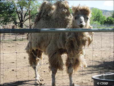 |
| And maybe camels. This guy was kind enough to guard our car while we sampled wetlands. |
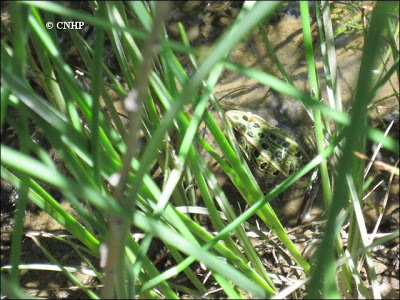 |
| We’ve seen a number of reptiles and amphibians this year. This is the elusive and State Species of Special Concern northern leopard frog (Rana pipiens). |
We are excited to head out and finish the playa sampling and head even further east and work in the dynamic South Platte River floodplain, looking at backwater channels, sandbars, and cottonwood gallery forests. It has been hot (104° F), windy, but surprisingly calm with the lightning, and so altogether quite pleasant. I still think that field work is the best way to see random places in the state you would normally never spend time in. So enjoy the pictures, they don’t do the wetlands justice (except for the playas).
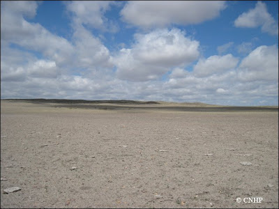 |
| Looks like a wetland, huh? This playa often has water several feet deep, but not after this dry winter and spring. |
 |
|
| I’d say that’s a high water table… |
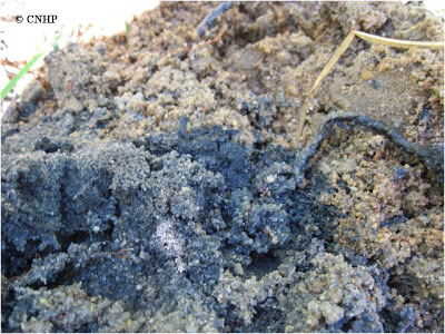 |
| Some interesting gley soils. They really are blue and grey-green! |

