


by Erick Carlson
The Colorado Natural Heritage Program has been active in generating wetlands maps for the state of Colorado for several years. The wetland ecologists and GIS mapping technicians team up to produce the best quality maps, for the largest area possible, as fast as we can. Colorado lags behind other western states in the amount of the state with wetland maps available in a digital (GIS) environment. The entire state of Colorado was initially mapped in the late 1970’s/early 1980’s when the National Wetlands Inventory program was initiated by the U.S Fish and Wildlife Service. The original effort produced paper maps with wetland boundaries and information about the type of wetland. Unfortunately, this is about as far as they got for several decades. As computerized mapping software became a daily tool used by natural resource planning professionals, it became necessary to take those paper maps and make them digital. As we began the process of converting the maps to digital files, it became apparent that much of the landscape had changed in the previous 30+ years. While a straight conversion from paper to digital is cheap and fast, working on updating the wetlands boundaries takes much longer.
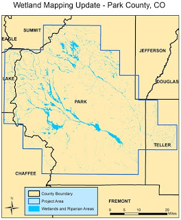
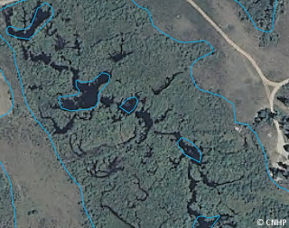
The cost and time associated with creating new wetland maps requires a more focused approach on a project by project basis, as the need and funds arise. Our most recent effort focused on Park County, Colorado. The South Platte River headwaters are located here as well as some unique saline flats and large high elevation fen complexes. Above is a map showing the extent of the project area and the extent of wetlands on the landscape.
To create a new wetland map, the mapping technicians look at several pieces of information to decide where a wetland exists and what type it is. The characteristics considered include the cover type (forest, herbs, sand, open water), the frequency of flooding (temporarily, permanently, seasonally) and if there are any modifications made by humans (canals, dams). For the Park County project area aerial photographs from the summer of 2009 and 2005 were viewed:
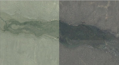
Summer 2005 on the left and summer 2009 on the right.
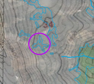
Possible fen identified on topographic map.
We also use the original effort from the NWI as the information can still be relevant. This can be especially helpful when deciding how often a wetland is likely to be flooded.
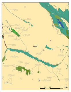
Original NWI mapping example.
Project numbers so far:
The total number of individual wetland polygons created – 23,788
The total acres of wetlands delineated – 69,914.7
The number of USGS 1:24,000 quadrangles mapped – 37
And now some pictures from field visits to sites to verify that what we were seeing on the aerial photographs matched what was on the ground. There were some tricky photo signatures that needed to be checked.
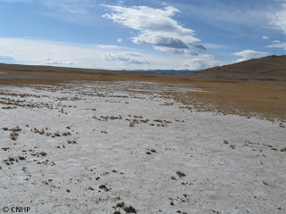
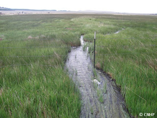
First a saline wetland, very interesting, with limited plant species diversity as there was a ¼ to 1” layer of salt on the soil surface – tough conditions.

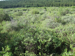
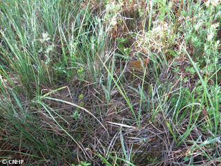
A shrubby riparian area, with lots of saturated spots was common in the higher elevations; and a close up of the mossy, sedgy, grassy under story.
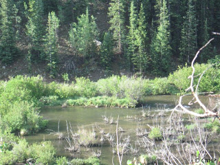
The ever dynamic beaver created ponds were easy to spot from aerial photographs or when we were perched above them on roads.
Lots of water for irrigation this year for hay pastures.
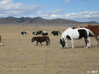
Wetlands can be different sizes and shapes, just like horses. We saw these little (and big) fellas while cruising area looking for wetlands.
A big thanks to Gabrielle Smith for putting up with me in the car, forcing her to camp in the cold, rain and mosquito filled South Park area. She was silly enough to accompany me up there twice!

