

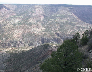
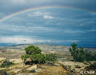
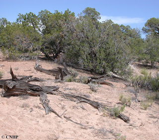
In Colorado, pinyon-juniper ecological systems may occur as shrublands or woodlands, or as sparsely vegetated bedrock canyon and tableland systems. This is the characteristic system of Colorado’s western mesas and valleys, where it is typically found at lower elevations (ranging from 4,900 – 8,000 ft) on dry mountains and foothills. Colorado Plateau Pinyon-Juniper stands may vary considerably in appearance and composition, depending on altitude and geographic location. Pinyon pine and/or Utah juniper form the canopy. Juniper is often more abundant at the lower elevations, while pinyon pine tends to be more abundant at the higher elevations. Rocky Mountain juniper may replace or co-dominate with Utah juniper at higher elevations. These woodlands often occur in a mosaic with other systems, including sagebrush, oak, and semi-desert shrublands. The understory is highly variable, and may be shrubby, grassy, sparsely vegetated, or rocky. Severe climatic events occurring during the growing season, such as frosts and drought, are thought to limit the distribution of pinyon-juniper systems to the relatively narrow altitudinal belts that they occupy.
Pinyon-juniper woodlands are influenced by climate, grazing, fires, tree harvest, and insect-pathogen outbreaks. Since the late 1800s, distribution and density of pinyon and juniper and the accompanying native understory has been significantly altered by changing fire frequency, grazing patterns, and climate cycles. In many places, these two tree species, especially juniper, have encroached on adjacent shrublands and grasslands, changing the habitats available to wildlife, as well as the forage available to domestic cattle. In this system, fire acts to open stands, increase diversity and productivity in understory species, and create a mosaic of stands of different sizes and ages across the landscape while maintaining the boundary between woodlands and adjacent shrubs or grasslands.
These woodlands are used by many common mammal species, including several bat species, desert and Nuttall’s cottontails, Mexican woodrats, rock squirrels, pinyon and deer mice, gray foxes, mule deer, and mountain lions. Common bird species include the pinyon jay, western scrub jay, turkey, chipping sparrow. A number of reptiles are characteristic, including the collared lizard, plateau lizard, and tree lizard. Pinyon-juniper is the third most important habitat in the state for Colorado’s rare plants. This is also an important habitat for birds, including the Gray Vireo, one of Colorado’s rare birds, and the black-throated gray warbler. Rare reptiles include the long-nosed leopard lizard.
Colorado Plateau pinyon-juniper covers nearly 5 million acres in western Colorado. Ownership is predominantly federal, mostly under the management of the Bureau of Land Management. Pinyon-juniper ecological systems have declined in both extent and quality compared to historic norms, although there are a number of very large patches remaining. Threats include urban development, recreation (especially motorized recreation), invasive species (most notably an increase in cheatgrass in the understory, which has led to increasing fire ignitions), and energy development.
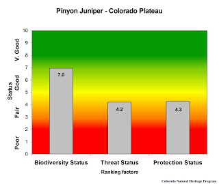
Overall biodiversity, threat, and protection status scores for
Colorado Plateau Pinyon-Juniper in Colorado.
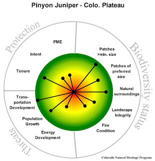
A “windrose” graph depicting Colorado Plateau Pinyon-Juniper status for individual scoring factors.

