Colorado Natural Heritage Program Logo Colorado Natural Heritage Program Logo CNHP
  • About Us
    • About Us
      • Biennial Report
      • Strategic Plan
    • Conserving Biodiversity
    • Contact Us
    • Staff Directory
    • Careers
      • Employment
      • Internship
      • Volunteer
    • Meetings
    • The NatureServe Network
    • Partners
  • Our Work
    • Ecology
    • Wetlands
    • Plants
    • Animals
    • Climate Change
    • Education
    • Invasive Species
  • Our Services
    • Database Development
    • GIS Analysis & Modeling
    • Mapping
    • Surveys & Inventories
    • Monitoring & Assessment
    • Conservation Planning
  • Our Data
    • About CNHP Data
    • Request Data
    • Contribute Data
    • Download Data
    • Tracking Lists
    • PCA Reports
    • Help & Documentation
  • Maps
    • CNHP Spatial Layers
    • Wetlands Mapper
    • COMaP
    • Conservation Environmental Review Tool
  • Library
    • Reports
    • PCA Reports
    • Tracking Lists
    • Field Guides
      • Rare Plant Guide
      • Colorado Wetland Field Guides
  • Blog
  • Donate Now

Vegetation mapping and collection at Great Sand Dunes

July 16, 2009

Great Sand DunesA view of the dunes from above

Field crews headed by CNHP Ecologist Joe Stevens have been working since 2005 at the Great Sand Dunes National Park and Preserve to classify and map the diverse vegetation of the Park as well as to collect and identify all known plant species within the Park.

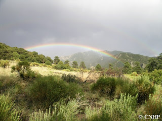
The Great Sand Dunes National Park and Preserve showcases a wide range of ecosystems on a steep elevational gradient, going from dunes, shrublands, lakes and wetlands on the valley floor (7,550 feet elevation) through montane and subalpine forest, to alpine tundra at over 13,000 feet in the space of just three or four miles. The project area boundary encompasses 413,000 acres.

There’s more to the Great Sand Dunes than just sand!

The vegetation mapping project is in collaboration with the National Park Service, U.S. Fish and Wildlife Service, U.S. Forest Service, U.S. Bureau of Reclamation, U.S. Geological Service, NatureServe, and The Nature Conservancy. The project is wrapping up this summer and will result in a detailed map of the area’s vegetation, descriptions of all the classified types, and a field key to the vegetation, representing approximately 200 different plant associations.

For the plant species collection project, CNHP assisted the Great Sand Dunes staff to identify vascular plant species within the Park, and to collect over 700 voucher specimens for the Park herbarium. A state-rare sedge, slender sedge (Carex lasiocarpa, G5S1) was documented, as well as western bitterweed (Rydbergia (Tetraneuris) brandegeei), a regional endemic found only in the Sangre DeCristo mountains in Colorado.

Astragalus ceramicusThe unusual Astragalus ceramicus (pottery milkvetch), found at the Great Sand Dunes

SHARE
FACEBOOK
TWITTER
LINKEDIN
REDDIT
EMAIL
Filed Under: Collaborations, Ecology, National Parks

CNHP Ecologist leads tour of Hanna Ranch
More field updates from Southeast Colorado

About Us

About Us
Conserving Biodiversity
Contact Us
Staff Directory
Careers
Employment
Internship
Volunteer
Meetings
The NatureServe Network
Partners

Our Work

Ecology
Wetlands
Plants
Animals
Climate Change
Education
Invasive Species

Blog Archive

Blog Categories

Web Projects

  • Rare Plant Guide Online
  • Colorado Wetland Info Center
  • COMaP - Colorado Protected Lands
  • Colorado Bat Working Group
  • STReaMS - Endangered Fishes Database

About Us

  • About Us
  • Conserving Biodiversity
  • Contact Us
  • Staff Directory
  • Careers
  • The NatureServe Network
  • Partners
  • Site Map
Warner College of Natural Resources Logo
  • Apply to CSU
  • Equal Opportunity
  • Disclaimer
  • Privacy Statement
  • Search CSU
  • CSU Land Acknowledgement
  • CSU Principles of Community
© 2026 Colorado Natural Heritage Program
Colorado State University Logo
  • About Us
    ▼
    • About Us
      ▼
      • Biennial Report
      • Strategic Plan
    • Conserving Biodiversity
    • Contact Us
    • Staff Directory
    • Careers
      ▼
      • Employment
      • Internship
      • Volunteer
    • Meetings
    • The NatureServe Network
    • Partners
  • Our Work
    ▼
    • Ecology
    • Wetlands
    • Plants
    • Animals
    • Climate Change
    • Education
    • Invasive Species
  • Our Services
    ▼
    • Database Development
    • GIS Analysis & Modeling
    • Mapping
    • Surveys & Inventories
    • Monitoring & Assessment
    • Conservation Planning
  • Our Data
    ▼
    • About CNHP Data
    • Request Data
    • Contribute Data
    • Download Data
    • Tracking Lists
    • PCA Reports
    • Help & Documentation
  • Maps
    ▼
    • CNHP Spatial Layers
    • Wetlands Mapper
    • COMaP
    • Conservation Environmental Review Tool
  • Library
    ▼
    • Reports
    • PCA Reports
    • Tracking Lists
    • Field Guides
      ▼
      • Rare Plant Guide
      • Colorado Wetland Field Guides
  • Blog
  • Donate Now