

Scientific Name : Astragalus detritalis
Author : M.E. Jones NatureServe Explorer
Common Name : Debris Milkvetch
 Current Research Activities
 1997 profile


☰ Click link below for details.
Taxonomy
Fabaceae (pea family)
Ranks and Status
State Rank : S2
State Rank Reason : Astragalus detritalis is known from 10-20 occurrences in northwestern Colorado, USA. The species is threatened by disturbance from livestock grazing, energy development and mining, disturbance from road building and maintenance, and invasive plant species. Effects from climate change is also considered a concern.
U.S. Endangered Species Act : none
Colorado Threatened and Endangered List : none
Other Statuses : BLM, SWAP Tier 2
Description and Phenology
General Description:
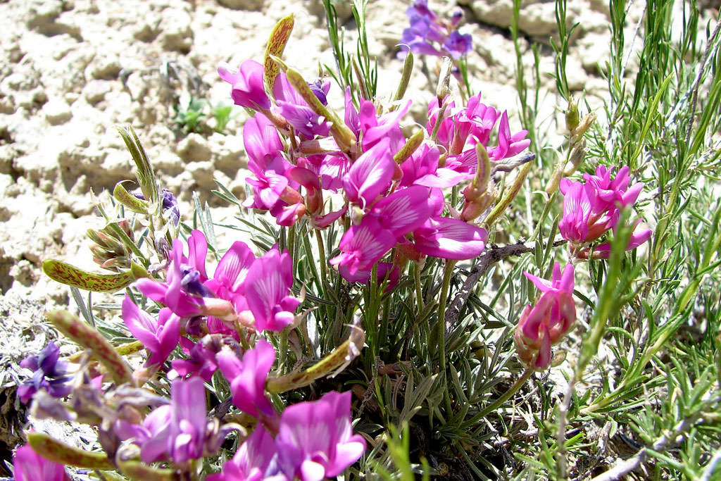
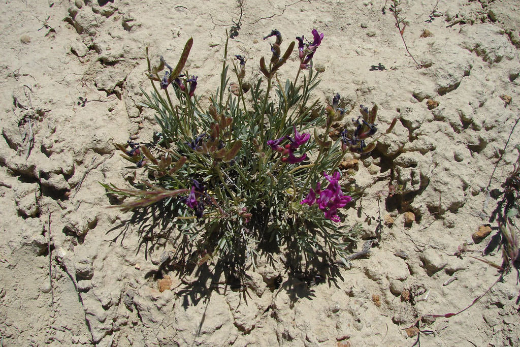
Stemless, erect, cushion-shaped perennial from 2 to 6 cm in height. Leaves with 3 to 5 narrowly oblanceolate to linear spinulose-tipped leaflets from 3 to 30 mm in length, with dolabriform hairs. Three to eight vivid pink-purple flowers produced in racemes; erect, sessile pods form in a close terminal cluster. The dark-colored, laterally-compressed pods are more than twice as long as wide, are not inflated and are unilocular. Pods are also slightly incurved, mottled, and sparsely strigose (Spackman et al. 1997, Ackerfield 2015).
Look Alikes:
A. calycosus var. scaposus has oval leaflets and smaller, densely strigose pods. A. spatulatus has smaller flowers and much shorter pods (Spackman et al. 1997).
Phenology:
Flowering late April to early June with a peak in mid-May; fruiting late May to late June (Neese and Smith 1982, Colorado Natural Heritage Program 2012).
Habitat
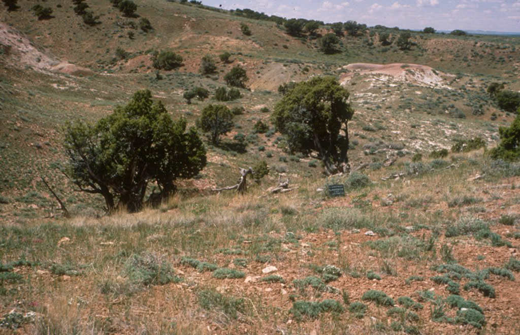
Found in barren habitats in pinyon-juniper and mixed desert shrub communities, often in rocky soils ranging from sandy clays to sandy loams, and on alluvial terraces with cobbles (Spackman et al. 1997). Associated with Artemisia, Stipa, Phlox, Trifolium, and cactus species.
click on image to enlarge
 |
Elevation Range:
5,385 - 7,212 feet (1,641 - 2,198 meters)
Distribution
Colorado Endemic:
No
Range:
Astragalus detritalis is known from Rio Blanco and Moffat counties in Colorado, USA. Estimated range extent in Colorado of 6421 square kilometers was calculated in GeoCAT using occurrence data provided by the Colorado Natural Heritage Program (2025). This species is also known from Utah. It is a Uintah Basin endemic (Welsh et al. 1993).
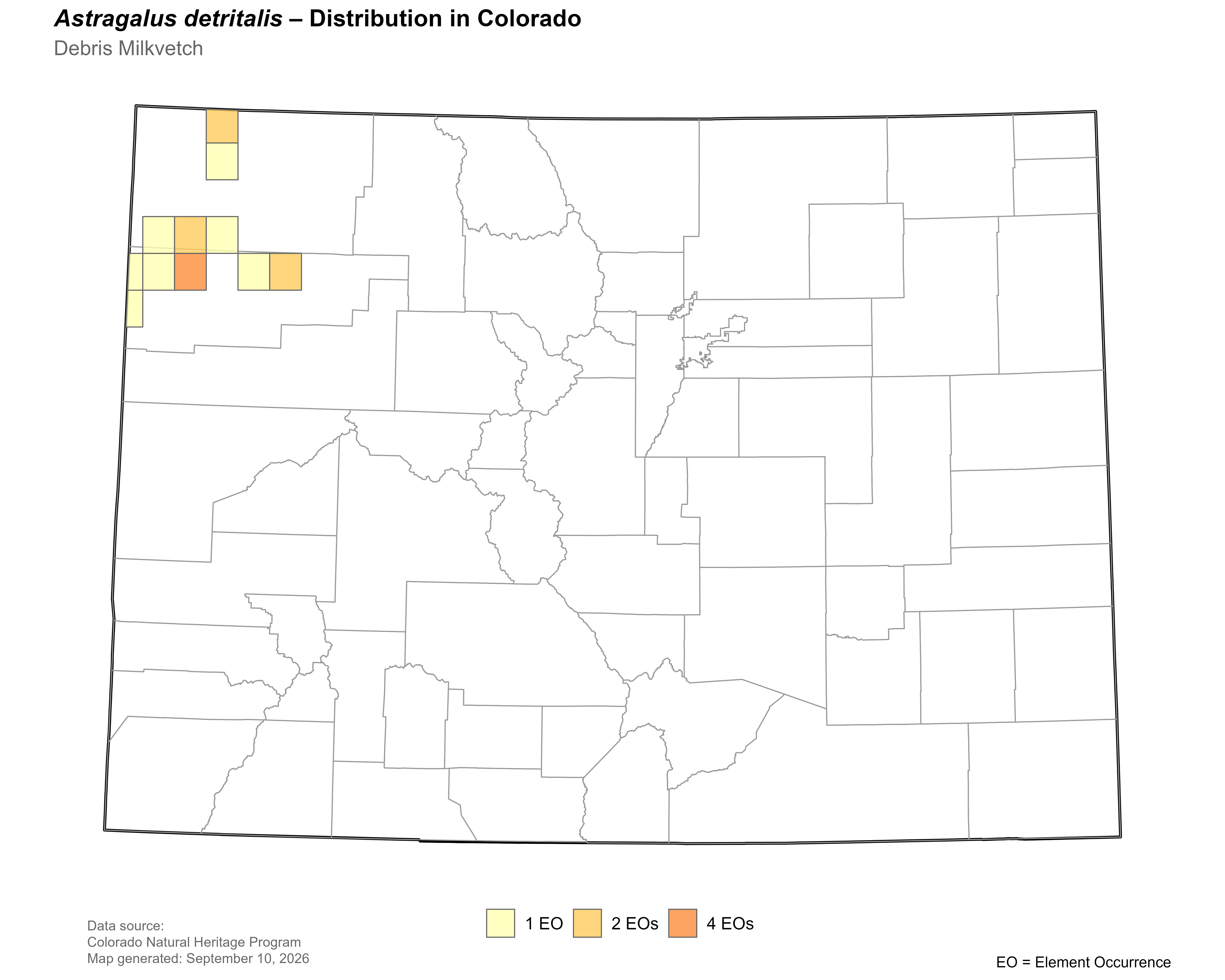
Click on map to enlarge |
Threats and Management Issues
As of 2022, 43% of the occurrences are found in habitat with moderate to high levels of landscape disturbance, the remainder are in areas of minimal to low level landscape disturbance (CNHP 2021). At the local level livestock grazing, energy development and mining, disturbance from road building and maintenance and invasive plant species are potential threats to the occurrences. This species is considered to have moderate adaptive capacity and is expected to be moderately vulnerable to climate change under both RCP 4.5 and 8.5 scenarios, as assessed for the 2025 Colorado State Wildlife Action Plan (CNHP 2025).
References
- Ackerfield, J. 2015. Flora of Colorado. BRIT Press, Botanical Research Institute of Texas, Fort Worth, TX. 818 pp.
- Barneby, R. C. 1964. Atlas of North American Astragalus. Memoirs of New York Botanical Garden, vol. 13. New York Botanical Garden, Bronx, NY.
- Colorado Natural Heritage Program (CNHP). 2022. Biodiversity Tracking and Conservation System (Biotics 5). Colorado Natural Heritage Program, Colorado State University, Fort Collins.
- Colorado Natural Heritage Program (CNHP). 2025. Biodiversity Tracking and Conservation System (Biotics 5). Colorado Natural Heritage Program, Colorado State University, Fort Collins.
- Colorado Natural Heritage Program (CNHP). 2025. Climate Change Vulnerability Assessment of Colorado Tier 1 and Tier 2 Plant Species of Greatest Conservation Need (SCGN) for the 2025 Colorado State Wildlife Action Plan. Colorado Natural Heritage Program, Colorado State University, Fort Collins.
- Colorado Natural Heritage Program. 2021. Landscape Disturbance Index Layer for Colorado. Edition 04_2021. Raster Digital Data Set. Colorado Natural Heritage Program, Fort Collins, CO. April 21, 2021.
- Goodrich, S. and E. Neese. 1986. Uinta Basin Flora. U.S.D.A. Forest Service, Ogden, UT.
- Kartesz, J.T. 1994. A synonymized checklist of the vascular flora of the United States, Canada, and Greenland. 2nd edition. 2 vols. Timber Press, Portland, OR.
- Neese, E., and F. Smith. 1982. Final Report: Threatened and endangered plant inventory for the Oil Shale RMP, Bookcliffs Resource Area, Utah Bureau of Land Management, Vernal District. Volume 1 - Text. Pp 1-88 + appendices.
- Spackman, S., B. Jennings, J. Coles, C. Dawson, M. Minton, A. Kratz, and C. Spurrier. 1997. Colorado rare plant field guide. Prepared for Bureau of Land Management, U.S. Forest Service and U.S. Fish and Wildlife Service by Colorado Natural Heritage Program.
- USDA, NRCS. 2013. The PLANTS Database. National Plant Data Team, Greensboro, NC 27401-4901 USA.
- USDA, NRCS. 2022. The PLANTS Database. National Plant Data Team, Greensboro, NC 27401-4901 USA.
- Weber, W. A. and R. C. Wittmann. 2012. Colorado Flora, Western Slope, A Field Guide to the Vascular Plants, Fourth Edition. Boulder, Colorado. 532 pp.
- Welsh, S.L., N.D. Atwood, S. Goodrich and L.C. Higgins. (Eds.) 2003. A Utah Flora. 3rd edition. Brigham Young University, Provo, Utah, U.S.A. 912 pp.